PREFIRE (Polar Radiant Energy in the Far-InfraRed Experiment) Mission
- 17 May 2024
Why is it in the News?
NASA is set to launch the two small satellites of the PREFIRE mission from New Zealand on May 22 aimed at filling in critical gaps in data from Earth's polar regions.
What is the PREFIRE Mission?
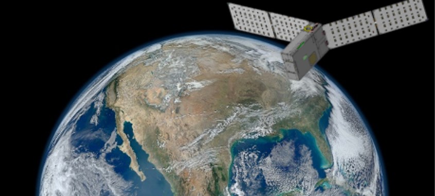
- PREFIRE (Polar Radiant Energy in the Far-InfraRed Experiment) is a NASA mission that involves sending two tiny twin spacecraft, known as CubeSats, to the Earth's polar regions to gather data on the heat energy radiated out to space and its impact on our climate.
- PREFIRE consists of two, 6U CubeSats with a baseline mission length of 10 months.
- These shoebox-sized satellites will orbit at altitudes between 292 and 403 miles, crossing paths in the atmosphere.
Objectives:
- The mission will help close a gap in understanding how much of Earth’s heat is lost to space, especially from the Arctic and Antarctica.
- Analysis of PREFIRE’s measurements will inform climate and ice models, providing better projections of how a warming world will affect sea ice loss, ice sheet melt, and sea level rise.
- Improving climate models can ultimately help to provide more accurate projections on the impacts of storm severity and frequency, as well as coastal erosion and flooding.
- By studying the far-infrared radiation emitted from these regions, PREFIRE will help improve the accuracy of climate models, enhancing our understanding of phenomena such as Arctic warming, sea ice loss, and ice-sheet melting.
The mission will help in:
- Uncover the reasons behind the Arctic warming more than 2½ times faster than the global average since the 1970s.
- Provide scientists with a clearer understanding of how efficiently far-infrared heat is emitted by materials such as snow and sea ice, and how clouds affect the amount of far-infrared radiation that escapes to space.
- Enhance predictions about future changes in the heat exchange between Earth and space, and how these changes will impact phenomena like ice sheet melting, atmospheric temperatures, and global weather patterns.
How will the Satellites Work?
- The mission with cube satellites about the size of a shoebox will be launched aboard an Electron launch vehicle.
- It is equipped with technology proven on Mars and will measure a “little-studied portion” of the radiant energy emitted by Earth.
- Two satellites carrying a thermal infrared spectrometer will be in asynchronous near-polar orbits and will be passing over a given spot on Earth at different times. To maximize coverage, they will be overlapping every few hours near the poles.
- The instruments weighing less than 6 pounds (3 kilograms) each will make readings using a device called a thermocouple, similar to the sensors found in many household thermostats.
Why is it Important to Study the Polar Regions?
- According to NASA, Earth's climate balance hinges on the equilibrium between the heat energy the planet receives from the Sun and the amount it radiates back into space.
- The difference between incoming and outgoing energy determines Earth's temperature and climate.
- The polar regions are crucial in this balance.
- Changes in the polar regions can significantly impact global weather patterns.
- Extreme storms, flooding, coastal erosion – all of these phenomena are influenced by what’s happening in the Arctic and Antarctic.
- This underscores the importance of understanding polar dynamics to predict and mitigate global climate effects.