8th Century Kotravai Sculpture from Pallava Period Discovered (Indian Express)
- 15 Feb 2024
Why is it in the News?
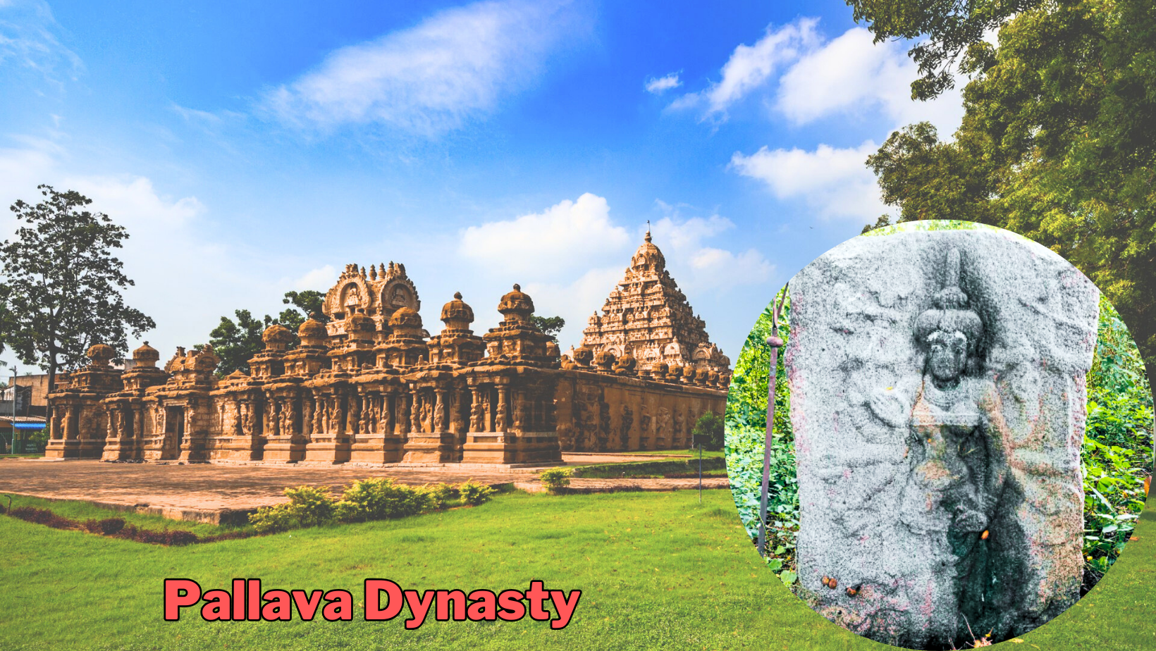
Recently, archaeologists discovered an eighth-century Kotravai sculpture, an artefact that dates back to the Pallava period, near Ulundurpet, Tamil Nadu.
About the Kotravai Sculpture:
- Kotravai sculpture is made in a slab stone of five-feet height and four-feet width.
- The idol is depicted with eight hands, indicating its origin in the eighth century during the Pallava period.
- The sculpture depicts various elements such as chakkara, sword, bell, and abhaya mudra in the right hands.
- Conch, bow, shield, and Uru Mudhra are shown in the left side hands along with bangles in all hands.
- The presence of trishul (soolam) and lion (simmam) on the right side of head, and blackbuck (kavarimann) on the left side.
- Kotravai is portrayed standing on the head of a buffalo, with two guards on each side.
About the Pallava Dynasty:
- The Pallava Dynasty, a prominent power in South India, thrived from the 3rd to the 9th centuries.
- Their dominion encompassed the northern regions of Tamil Nadu, portions of Karnataka, Andhra Pradesh, and Telangana, with Kanchipuram serving as their capital.
- The Pallavas were known for their patronage of Buddhism, Jainism, and Brahminical faith, as well as their support for music, painting, and literature.
- Origins: Initially vassals of the Andhra Satavahanas, the Pallavas gained autonomy following the latter's decline in Amaravati.
- Gradually expanding southward, they established their capital in Kanchipuram during the 4th century CE.
- Under the reigns of Mahendravarman I (571 - 630 CE) and Narasimhavarman I (630 - 668 CE), the Pallava realm experienced significant growth in wealth and power.
- According to the accounts of Chinese traveller Hiuen Tsang, Bodhidharma, the founder of the Chan (Zen) school of Buddhism in China, was purportedly a prince of the Pallava empire.
- The Chinese traveller Hiuen Tsang visited Kanchipuram, the capital of Pallavas, during the reign of Narasimha Varman I and lauded their benevolent governance.
Architectural Contributions of the Pallavas:
- The Pallava Dynasty is renowned for its patronage of Dravidian architecture, particularly temple construction.
- They played a pivotal role in the evolution from rock-cut architecture to stone temples.
- Their most celebrated architectural achievements can be found in Mahabalipuram, which flourished as a significant hub of art, architecture, and literature during Pallava rule.
- Narasimhavarman II commissioned notable structures such as the Kailasanatha Temple in Kanchipuram and the Shore Temple.
- Among these temples, Kailasanatha and Vaikuntaperumal stand out for their architectural excellence.
- The Vaikuntaperumal shrine, erected in the 8th century AD, is renowned for its intricate sculptures depicting Pallava history.
- Religion: The Pallavas embraced Shaivism, a predominant local religion, thereby aligning themselves with Dravidian cultural traditions.
Military Engagements and Decline of the Pallava Dynasty:
- Throughout their reign, the Pallavas engaged in persistent conflicts with both the Chalukya Dynasty to the north and the Tamil kingdoms of Chola and Pandyas to the south.
- The Pallavas faced ongoing battles with the Chalukyas of Badami and ultimately succumbed to the supremacy of the Chola kings in the 8th century CE.
- The ascent of the Rashtrakutas marked the decline of the Pallava Dynasty.
- In 897 AD, Vijayalaya, the Chola King, decisively defeated Aparajitavarman, the last Pallava King, thereby sealing the fate of the Pallava Dynasty.
Alaskapox Claims One Life in US (TOI)
- 15 Feb 2024
Why is it in the News?
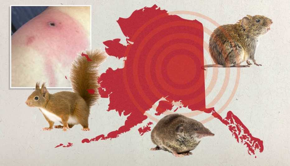
An elderly man has died from Alaskapox, the first known fatality from the recently discovered virus.
What is Alaskapox?
- Alaskapox is caused by orthopoxvirus, a family of brick-shaped viruses that can infect both animals and humans, leading to skin lesions or pox.
- The virus was first identified in a woman living near Fairbanks, Alaska, and has since been primarily detected in small mammals like red-backed voles and shrews.
- However, domestic pets such as dogs and cats may also be carriers of the virus.
What are the symptoms of Alaskapox?
- Symptoms of Alaskapox include the development of one or more bumps or pustules on the skin, accompanied by joint or muscle pain and swollen lymph nodes.
- While the majority of the seven known human cases in Alaska over the past nine years have experienced mild illnesses that were resolved without intervention, the virus poses a greater threat to individuals with weakened immune systems.
How is Alaskapox Transmitted?
- Transmission of Alaskapox is believed to occur through direct contact with infected animals.
- Unlike some of its orthopoxvirus relatives, there have been no documented instances of Alaskapox spreading from person to person.
- Though it's not clear how Alaskapox is transmitted, researchers say that it may be zoonotic meaning it can jump from animals to humans.
PM Modi addresses World Government Summit 2024 in Dubai (MEA)
- 15 Feb 2024
Why is it in the News?
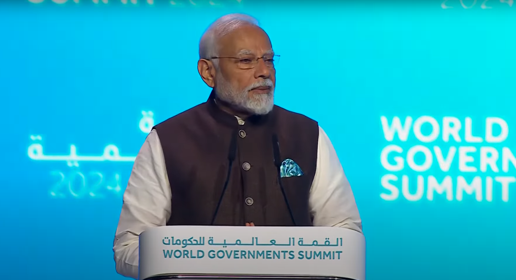
Prime Minister Modi attended the World Government Summit 2024 as guest of honour in Dubai recently.
What is the World Governments Summit?
- The World Governance Summit serves as a worldwide platform committed to shaping the trajectory of government initiatives across the globe.
- This annual gathering takes place in Dubai, United Arab Emirates, convening leaders and experts from various sectors.
- Each year, the Summit sets the agenda for the forthcoming era of governance, emphasising the utilisation of innovation and technology to address pressing global challenges.
- Since its establishment in 2013, the Summit has been steadfast in its mission to influence the evolution of governmental practices and foster a brighter future for humanity.
World Governance Summit Organization:
- The World Governance Summit Organization operates as an impartial, nonprofit entity with a global reach, dedicated to influencing the future landscape of governance.
- Headquartered in Dubai, United Arab Emirates, the organisation serves as a nexus for collaboration and idea exchange among governmental and non-governmental stakeholders.
- 2024 Summit: Dubai, United Arab Emirates
- Theme - 'Shaping Future Governments'
Key Highlights of PM Modi's Speech:
- Streamlining Government Operations: The Prime Minister addressed the evolving landscape of governance, emphasising India's adoption of transformative reforms under the ethos of "Minimum Government, Maximum Governance.”
- Human-Centred Governance: Drawing from India's experience leveraging digital technology for welfare, inclusivity, and sustainability, he advocated for a human-centred approach to governance.
- He highlighted India's focus on people's participation, last-mile delivery, and women-led development to foster an inclusive society.
- Need for Global Collaboration: Given the interconnected nature of the world, the Prime Minister stressed the importance of governments collaborating and learning from each other to tackle future challenges effectively.
- Model of Governance: Highlighting the current imperative, the Prime Minister underscored the necessity for governance to be inclusive, technologically adept, transparent, and environmentally sustainable.
- He outlined priorities such as Ease of Living, Justice, Mobility, Innovation, and Business in public service delivery.
- India's Climate Change Commitment: Reaffirming India's unwavering commitment to climate change action, he urged people to join Mission LiFE (Lifestyle for Environment) to foster a sustainable world.
- Leadership Role of India: The Prime Minister elaborated on India's leadership role, particularly as the chair of G-20, highlighting efforts to address global challenges and elevate development concerns of the Global South.
- He advocated for reforming multilateral institutions to give greater voice to the Global South in decision-making processes.
- India as a Global Partner: Emphasising India's commitment to global progress, he reiterated India's role as a "Vishwa Bandhu" (friend of the world), pledging continued contributions to global advancement.
China Moves its Nationals into its Vacant ‘Defence Villages’ Along LAC (Indian Express)
- 15 Feb 2024
Why is it in the News?
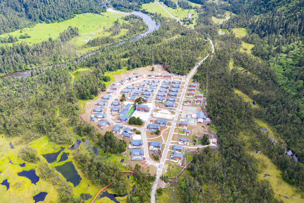
Chinese nationals have started occupying several of their model “Xiaokang” border defence villages across India’s north-eastern borders which the country has been building along the Line of Actual Control (LAC) since 2019.
News Summary:
- Chinese activity has been observed in several villages situated on its side of the Line of Actual Control (LAC) opposite the Lohit Valley and the Tawang sector of Arunachal Pradesh.
- Over the past five years, China has been undertaking the construction of 628 "well-off villages" along India's borders with the Tibet Autonomous Region, encompassing regions like Ladakh and Arunachal Pradesh.
- The precise purpose of these villages remains ambiguous, although the structures are believed to serve as "dual-use infrastructure," serving both civilian and military functions.
What is the Line of Actual Control (LAC)?
- The LAC serves as the boundary separating areas under Indian administration from those under Chinese administration.
- However, it is not a formally agreed-upon boundary, lacking delineation on maps or physical demarcation on the ground.
- India views the LAC as approximately 3,488 km in length, while China's perspective estimates it to be around 2,000 km.
- The LAC is segmented into three sectors: the eastern sector covering Arunachal Pradesh and Sikkim, the middle sector spanning Uttarakhand and Himachal Pradesh, and the western sector in Ladakh.
- India's official boundary line, as depicted on maps released by the Survey of India, encompasses both Aksai Chin and Gilgit-Baltistan, diverging from the LAC.
- Consequently, the LAC does not coincide with India's claim line.
- For China, the LAC generally aligns with its claim line, except in the eastern sector, where it asserts control over the entire territory of Arunachal Pradesh, which it regards as South Tibet.
Dispute over the LAC and Controversy Surrounding Claim Lines in Ladakh:
- India disputes the validity of the Line of Actual Control (LAC), asserting that it is a construct devised by China.
- The Chinese demarcation appears as a series of disconnected points on a map, lacking a clear and consistent delineation.
- India contends that the line should exclude territorial gains made through aggression in 1962 and instead reflect the positions as of September 8, 1962, before the Chinese incursion.
- This ambiguity in the Chinese definition of the LAC leaves room for China to pursue incremental changes on the ground through military actions, as evidenced by the clash in the Galwan Valley between the Indian Army and the Chinese PLA in 2020.
- Aksai Chin, located in the Ladakh region of the princely state of Jammu and Kashmir, was not part of British India, despite being under British Empire control.
- As a result, while the eastern boundary was clearly defined in 1914 with the signing of the Shimla Agreement on the McMahon Line by British India, the western boundary in Ladakh remained unresolved.
- These historical maps, still officially recognized today, formed the basis of engagements with China, ultimately culminating in the 1962 War.
Infrastructure Development along the LAC:
- Consistently, China has enhanced its existing infrastructure along the Line of Actual Control (LAC), focusing on improving connectivity through mountain passes, constructing roads, bridges, and model villages.
- Additionally, China has been constructing infrastructure, including border villages, within Bhutanese territory.
- Over the past three to four years, India has intensified efforts to bolster its border infrastructure, encompassing initiatives to enhance forward connectivity, establish alternative routes to the LAC, and connect remote areas.
- India's Vibrant Villages program aims to modernise 663 border villages, providing them with essential amenities in the initial phase.
- Notably, 17 of these villages located along the borders with China in Ladakh, Himachal Pradesh, Uttarakhand, Sikkim, and Arunachal Pradesh have been earmarked for development as pilot projects under this program.
- Moreover, significant progress is underway on three major highways in Arunachal Pradesh:
- The Trans-Arunachal Highway
- The Frontier Highway, and
- The East-West Industrial Corridor Highway.
Stone Age Wall Discovered Beneath the Baltic Sea (India Today)
- 15 Feb 2024
Why is it in the News?
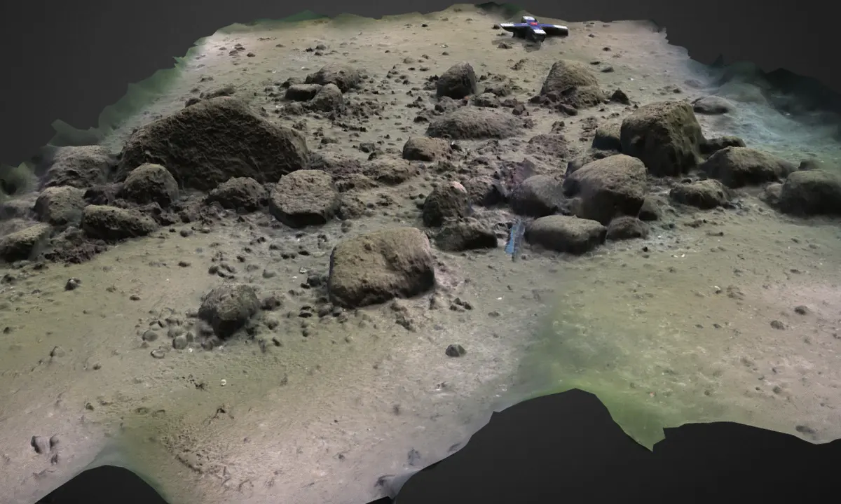
A megastructure found in the Baltic Sea may represent one of the oldest known hunting structures used in the Stone Age — and could change what’s known about how hunter-gatherers lived around 11,000 years ago.
About the Blinkerwall:
- The Blinkerwall is the oldest known megastructure crafted by humans in Europe.
- It is around a kilometre-long structure that lies hidden in the Bay of Mecklenburg, submerged under 21 metres of water.
- It consists of approximately 1,400 smaller stones intricately positioned to connect almost 300 larger boulders, some of which were deemed too massive for human groups to have manoeuvred.
- The total weight of the wall's stones exceeds 142 tonnes, making it improbable that natural processes, such as tsunamis or glacial movements, formed it.
- It likely dates back over 10,000 years, sinking beneath rising sea levels around 8,500 years ago.
- This positions it among the oldest known examples of hunting architecture globally and potentially designates it as the oldest man-made megastructure in Europe.
About the Baltic Sea:
- The Baltic Sea is a semi-enclosed inland sea situated in Northern Europe.
- As an arm of the North Atlantic Ocean, it stretches northward from the latitude of southern Denmark nearly to the Arctic Circle, acting as a divider between the Scandinavian Peninsula and the rest of continental Europe.
- With a coastline spanning approximately 8,000 km, the Baltic Sea is bordered by several countries, including Sweden, Poland, Lithuania, Latvia, Finland, Estonia, Germany, Denmark, and Russia.
- Covering an area of around 377,000 sq.km, the sea measures approximately 1,600 km in length and 193 km in width.
- It is linked to the White Sea via the White Sea Canal and to the North Sea's German Bight through the Kiel Canal, while it connects to the Atlantic Ocean through the Danish Straits.
- The Baltic Sea encompasses three significant gulfs: the Gulf of Bothnia to the north, the Gulf of Finland to the east, and the Gulf of Riga slightly to the south.
- Renowned as the world's largest brackish inland water body, the Baltic Sea exhibits lower water salinity levels compared to the World Oceans due to freshwater influx from the surrounding land and its shallow depth.
- More than 250 rivers and streams discharge into the Baltic Sea, with the Neva River being the largest among them.
- The sea boasts over 20 islands and archipelagos, with Gotland, located off the coast of Sweden, ranking as the largest island in the Baltic Sea.
