Expanding Glacial Lakes in the Indian Himalayas: ISRO
- 27 Apr 2024
Why is it in the News?
Experts express concern over the ISRO analysis findings, indicating that the expansion of glacial lakes due to warming could result in cascading impacts in lower regions.
Highlights of the ISRO Report:
- The ISRO report said 601 glacial lakes, or 89 percent, have expanded more than twice, and 10 lakes have grown between 15 times and double their size. Sixty-five lakes have expanded 1.5 times.
- Of the 2,431 glacial lakes larger than 10 hectares, 676 have significantly expanded, and at least 130 of these lakes are in India 65 (Indus River basin), 7 (Ganga River basin), and 58 (Brahmaputra River basin).
- Elevation-based analysis shows 314 lakes are located in the 4,000 to 5,000 meters range, and 296 lakes are above 5,000 meters elevation.
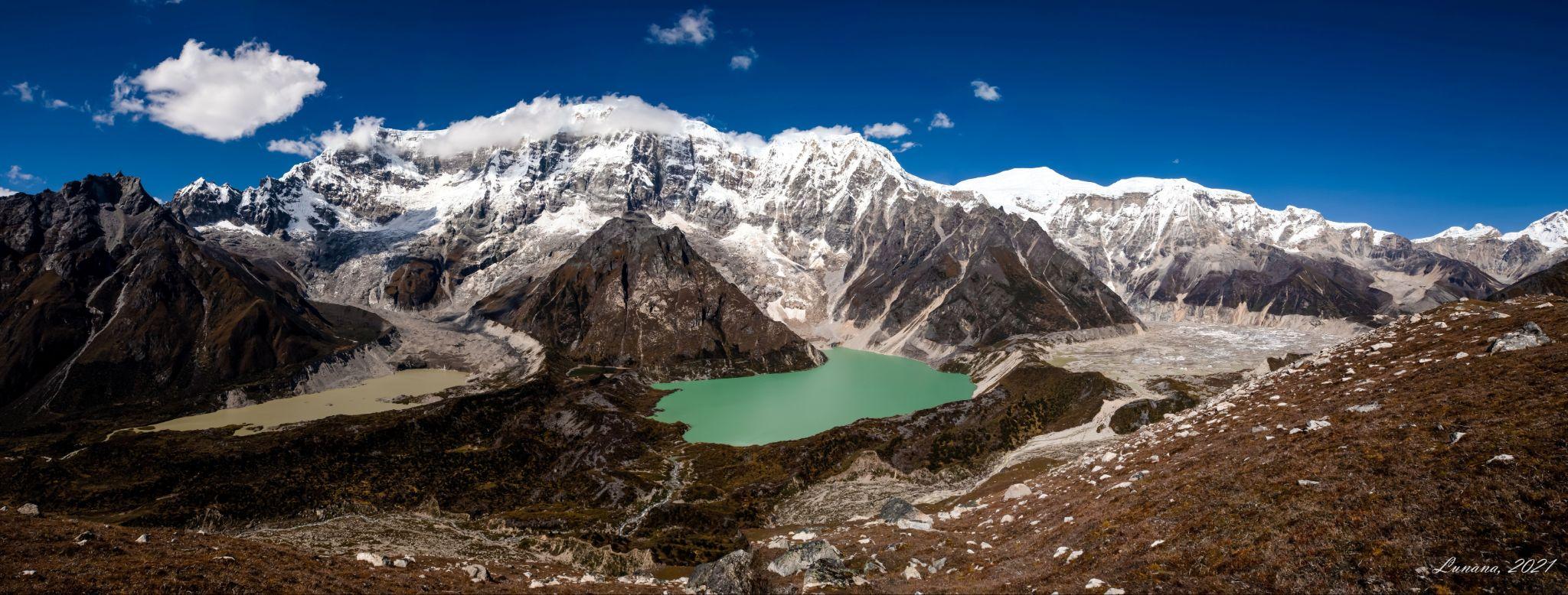
What are Glacial Lakes?
- Glacial lakes emerge in hollows or basins shaped by glaciers' erosive force and are prevalent in areas where glaciers once existed or persist.
- They vary widely in size and shape, from tiny pools to expansive bodies of water.
- ISRO classifies them into four main types: moraine-dammed, ice-dammed, erosion-based, and 'others'.
- While vital as freshwater sources for rivers, glacial lakes also pose risks, particularly Glacial Lake Outburst Floods (GLOFs).
- GLOFs occur when these lakes discharge large volumes of meltwater, often due to natural dam failures, causing sudden and severe downstream flooding.
Formation Processes:
- Glacial Erosion: Glaciers, moving slowly, sculpt the landscape by eroding bedrock through abrasion and plucking, creating valleys and basins.
- Moraine Deposition: As glaciers move, they transport sediment, depositing it at their edges as moraines, which can act as natural dams, forming lake basins.
- Ice Melting: Rising temperatures or glacier retreat causes ice to melt, filling depressions created by erosion with water, and forming glacial lakes.
- Terminal Moraine Formation: Glaciers may leave behind ridges of sediment at their terminus, creating natural dams that trap water, forming terminal moraine lakes.
Utilization of Remote Sensing for Glacial Lake Monitoring:
- Monitoring glacial lakes in the Himalayan region presents challenges due to rugged terrain, making satellite remote-sensing technology indispensable.
- By analyzing satellite data, changes in glacial lakes can be tracked over time, offering insights into their evolving dynamics.
- This data is vital for understanding their environmental impact and devising strategies to manage risks such as glacial lake outburst floods (GLOFs) and adapt to climate change in glacier-influenced regions.
Mitigating Risks Associated with Glacial Lakes:
- Research suggests that reducing glacial lake levels by 10 to 30 meters can significantly alleviate downstream impacts, albeit not eliminate GLOF risks.
- One effective method involves siphoning off lake water using extended High-Density Polyethylene (HDPE) pipes.
- In 2016, the Sikkim State Disaster Management Authority successfully employed this technique to lower water levels in South Lhonak Lake, showcasing its practicality and efficacy in risk reduction efforts.