1984 Bhopal disaster
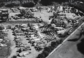
- 04 Dec 2024
In News:
Forty years after the Bhopal disaster on December 2-3, 1984, several hundred tonnes of toxic waste still remain around the ill-fated Union Carbide plant.
Overview of the incident:
The 1984 Bhopal disaster, one of the world’s worst industrial accidents, was caused by the release of methyl isocyanate (MIC) gas, which was a key component in the production of pesticides at the Union Carbide India Limited (UCIL) plant. However, the toxic legacy of the disaster extends far beyond MIC, with a range of other harmful substances lingering in the environment. These include:
- Methyl Isocyanate (MIC):Primary toxic agent: MIC is a highly toxic, volatile compound. Exposure can cause severe respiratory distress, eye irritation, pulmonary edema, and even death.
- Heavy Metals:The site of the plant is contaminated with various heavy metals, including:
- Mercury: Known to accumulate in the body and affect the nervous system, kidneys, and liver. Even small doses over time can lead to chronic health problems.
- Chromium: Exposure to high levels of chromium, particularly hexavalent chromium, is associated with lung cancer and damage to the respiratory system.
- Lead: A potent neurotoxin, lead can cause developmental delays, memory problems, and damage to the kidneys.
- Nickel: Can cause respiratory and lung cancers when inhaled in significant quantities.
- Copper: High levels of copper exposure can damage the liver and kidneys.
- Organic Compounds:Several organic chemicals were found at the site, including:
- Hexachlorobutadiene: A suspected carcinogen that can cause liver damage, kidney damage, and neurological issues upon exposure.
- Chloroform (Trichloromethane): Known for its effects on the central nervous system, exposure can lead to dizziness, loss of consciousness, and even death at high concentrations. It is also a possible carcinogen.
- Carbon Tetrachloride: A potent liver toxin, exposure can result in liver damage, cancer, and nervous system toxicity.
- Trichlorobenzene: These compounds are volatile and can spread through air and water, accumulating in fatty tissues and causing damage to organs like the liver and kidneys.
- Persistent Organic Pollutants (POPs):Some of the contaminants, particularly the organic compounds, are classified as persistent organic pollutants, which do not degrade easily in the environment. These can lead to:
- Cancer: Several of these compounds are carcinogenic.
- Neurological damage: Prolonged exposure can affect both the central and peripheral nervous systems.
- Reproductive and developmental disorders: Exposure has been linked to adverse effects on fertility and developmental health in humans.
- Environmental and Long-term Health Effects:
- Even decades later, contamination continues to affect the health of people living around the site, with high rates of cancers, birth defects, respiratory diseases, and other health issues. Water sources in the region remain unsafe due to heavy contamination with toxic chemicals. Persistent organic pollutants have been identified in local communities, indicating that the contamination continues to spread.
Wayanad’s New X-Band Radar

- 14 Oct 2024
In News:
- Following devastating floods and landslides in July 2024 that resulted in over 200 fatalities in Wayanad, Kerala, the Union Ministry of Earth Sciences approved the installation of an X-band radar to enhance monitoring and early warning systems.
- Impact of Events: The floods were exacerbated by heavy rains, leading to significant debris flows and landslides, highlighting the need for advanced meteorological tools.
What is Radar?
- Definition: Radar stands for "Radio Detection and Ranging." It uses radio waves to determine the distance, velocity, and characteristics of objects.
- Functioning: A transmitter emits radio signals that reflect off objects, returning to a receiver for analysis. This technology is crucial in meteorology for monitoring weather patterns.
X-Band Radar Specifics
- Operating Frequency: X-band radar operates at 8-12 GHz, corresponding to wavelengths of 2-4 cm. This allows it to detect smaller particles, such as raindrops and soil.
- Advantages: The shorter wavelengths provide higher resolution images but have a limited range due to faster signal attenuation.
- Applications: In Wayanad, the radar will monitor particle movements like soil, enabling timely landslide warnings through high temporal sampling.
India’s Radar Network
- Historical Context: India has utilized radar for meteorological purposes since the early 1950s. The first indigenous X-band radar was established in 1970.
- Current Infrastructure: India operates both X-band and S-band radars (2-4 GHz) for various meteorological functions. The X-band network includes storm detection and wind-finding capabilities.
- Future Plans: The Indian government plans to add 56 more Doppler radars under the ?2,000-crore "Mission Mausam," enhancing weather forecasting capabilities across the country.
NISAR Satellite
- Collaboration: NISAR (NASA-ISRO Synthetic Aperture Radar) is a joint satellite project between NASA and ISRO, set to launch in 2025.
- Capabilities: It will feature L-band and S-band radars to monitor Earth’s landmass changes, further supporting environmental monitoring and disaster management.
EXERCISE AIKYA
- 21 Sep 2024
In News:
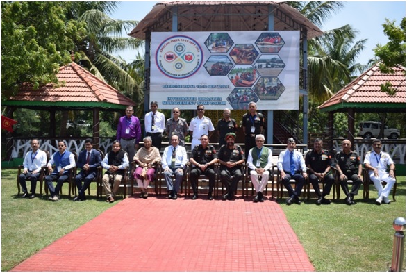
The National Disaster Management Authority (NDMA), in partnership with the Indian Army's Southern Command and the Tamil Nadu State Disaster Management Authority (TNSDMA), recently conducted "EXERCISE AIKYA" in Chennai. This two-day Integrated Symposium and Table Top Exercise (TTEx) aimed to bolster disaster preparedness and response among key stakeholders across Peninsular India.
Key Highlights:
- Objective: "Aikya," meaning "Oneness" in Tamil, sought to unify India’s disaster management community by enhancing collaboration and preparedness.
- Participants: The exercise involved representatives from:
- Six southern states/UTs: Tamil Nadu, Kerala, Karnataka, Andhra Pradesh, Telangana, and Puducherry.
- Central ministries related to disaster management.
- State Disaster Management Authorities (SDMAs).
- Armed forces, including the Indian Army, Navy, and Air Force.
- Response agencies such as the NDRF, Indian Coast Guard, CRPF, CISF, and Railways.
- Early warning agencies including the IMD, NRSC, INCOIS, CWC, and FSI.
- Research institutions like NIDM, NIOT, IIT Madras, and DAE, with Prof. CVR Murty of IIT Madras serving as the Exercise Mentor.
- Focus Areas: The exercise simulated various emergency situations, covering:
- Tsunamis, landslides, floods, cyclones, industrial incidents, and forest fires.
- Recent disaster events in Tamil Nadu, Wayanad, and Andhra Pradesh.
- Discussions: Participants engaged in discussions about:
- Leveraging technology and AI for disaster management.
- Economic impacts of disasters.
- Vulnerabilities specific to the Peninsular region.
- Strategies for improving response times.
Future Plans
"EXERCISE AIKYA" marks a crucial step towards strengthening India’s disaster management framework. The NDMA and the Southern Command plan to conduct similar exercises with other military commands and institutions, including the Army War College and Naval War College, to further enhance national disaster preparedness and response capabilities.
Operation Sadbhav
- 15 Sep 2024
In News:
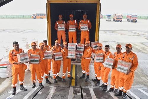
India has launched Operation Sadbhav to deliver crucial humanitarian aid to Myanmar, Laos, and Vietnam, all of which have been devastated by Typhoon Yagi. This powerful storm, the most severe in Asia this year, has led to extensive flooding and widespread destruction across the affected countries.
Relief Efforts:
In response to the crisis, India has mobilized a significant amount of aid. The Indian naval ship INS Satpura has transported 10 tonnes of relief supplies, including dry rations, clothing, and medicines, to Myanmar. Concurrently, the Indian Air Force has dispatched a military transport aircraft with 35 tonnes of aid to Vietnam and an additional 10 tonnes to Laos. The aid includes essential items such as generators, water purification systems, hygiene kits, mosquito nets, blankets, and sleeping bags, which are crucial for addressing immediate needs during this emergency.
India's Proactive Approach:
Operation Sadbhav highlights India's proactive approach to humanitarian assistance and disaster relief, emphasizing its role as a leading responder in the region. This initiative reflects India's commitment to providing support to its neighboring countries in times of crisis and aligns with its broader 'Act East Policy,' which aims to strengthen relations with ASEAN member states through practical assistance and cooperation.
Strategic Importance:
The operation also underscores India's strategic goals of enhancing regional stability and reinforcing its position as a reliable partner in disaster management. By providing timely aid, India demonstrates its dedication to supporting regional stability and contributing to international humanitarian efforts.
Global Recognition and Cooperation:
India's response to Typhoon Yagi has received international acknowledgment for its effectiveness and promptness. The coordination of these relief efforts highlights the importance of global solidarity in addressing humanitarian crises and building resilience in disaster-affected regions.
Conclusion:
Operation Sadbhav is a clear demonstration of India's commitment to timely and substantial humanitarian assistance. It not only showcases India's proactive diplomacy but also strengthens its ties with ASEAN nations through meaningful cooperation in times of adversity. The ongoing relief efforts are a testament to India's role as a responsible global stakeholder in disaster response and recovery.
Disaster Management (Amendment) Bill, 2024
- 05 Sep 2024
In News:
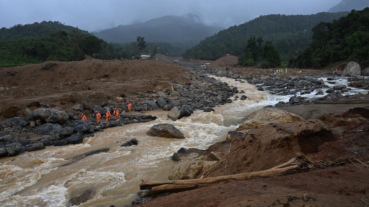
On August 1, 2024, the central government introduced the Disaster Management (Amendment) Bill in the Lok Sabha. This Bill, aimed at amending the existing Disaster Management Act of 2005, has been proposed in response to the increasing frequency of climate-induced disasters. However, the Bill’s provisions have raised concerns about further centralisation of disaster management processes, which may complicate and delay disaster response efforts.
Centralisation Concerns
The Bill continues the trend of centralising disaster management, a feature already prevalent in the 2005 Act. It grants statutory status to existing bodies like the National Crisis Management Committee (NCMC) and the High-Level Committee (HLC), potentially complicating the disaster response process. This centralised approach has previously led to delays, such as the late disbursement of funds to Tamil Nadu and Karnataka, contrary to the Act's intended rapid response.
Proposed Changes
Strengthening NDMA and SDMAs: The Bill aims to bolster the role of the National Disaster Management Authority (NDMA) and State Disaster Management Authorities (SDMAs) by having them prepare disaster management plans directly. It also introduces Urban Disaster Management Authorities (UDMAs) for state capitals and major cities, although these bodies may face challenges due to insufficient financial devolution.
Database and Staffing: The Bill mandates the creation of comprehensive disaster databases at national and state levels and allows the NDMA to appoint its own staff, subject to central government approval.
Issues with the Current Definition of ‘Disaster’
Heatwaves Exclusion: On July 25, 2024, the Minister of State for Science, Technology, and Earth Sciences announced that heatwaves will not be classified as a notified disaster under the Act. This decision aligns with the 15th Finance Commission’s view and maintains a restricted list of disasters eligible for assistance, which includes cyclones, droughts, earthquakes, and floods, but excludes climate-induced phenomena like heatwaves.
Inadequate Definition: The existing definition of "disaster" in the Act and the Bill remains narrow, failing to encompass climate-induced events such as heatwaves, which are increasingly recognized globally as significant disasters. Data from the India Meteorological Department shows a record number of heatwave days and related fatalities, highlighting the need for a broader disaster definition.
Critical Issues
Central-State Dynamics: The Bill’s centralisation raises questions about the balance of power between central and state governments. There are concerns that states will remain heavily dependent on central funds, complicating disaster management and response.
Lessons Unlearned: Despite being an update to the 2005 Act, the Bill appears to overlook past shortcomings, including delays in financial preparedness and response. A focus on cooperative federalism and effective disaster management should prioritize practical solutions over a central versus state blame game.
Future Directions: Addressing the challenges of climate-induced disasters and ensuring effective financial and operational preparedness requires revisiting and refining the disaster management framework. Emphasizing cooperative federalism and proactive disaster management strategies will be crucial in improving disaster resilience and response in the face of escalating climate risks.
Can Kerala access funds from the Loss and Damage Fund?

- 06 Sep 2024
In light of the recent landslides in Kerala’s Wayanad district, the question arises whether subnational entities like Kerala can access the United Nations Framework Convention on Climate Change (UNFCCC)’s Loss and Damage Fund (LDF). While the need for compensation is clear, the process of accessing climate funds is complex.
What is the Loss and Damage Fund (LDF)?
- Established at COP27 in Egypt, the LDF aims to support regions experiencing economic and non-economic losses from climate change.
- Includes extreme weather events and slow-onset processes like rising sea levels.
- Managed by a Governing Board, with the World Bank as the interim trustee.
- The Board is developing mechanisms for resource access, such as direct access, small grants, and rapid disbursement options.
- Concerns exist about the speed and accessibility of climate funds, which may affect their effectiveness in immediate disaster recovery.
What has been India’s Role?
- India faced over $56 billion in weather-related damages from 2019 to 2023. Despite this, its National Climate Action Policy prioritizes mitigation over adaptation, leading to limited engagement in Loss and Damage dialogues at COP meetings.
- High vulnerability in certain regions could benefit from active participation in these dialogues.
- India needs a clear legal and policy framework for climate finance, focusing on locally led adaptation, which is vital for vulnerable communities.
- The Union Budget 2024’s introduction of a climate finance taxonomy raises hopes for increased international climate finance.
- Without clear guidelines for accessing loss and damage funds, frontline communities remain at risk.
- India should advocate for decentralized fund disbursement methods from the LDF, contrasting with the centralized systems used for other climate funds.
What have been State Interventions?
- State governments, such as Kerala, often bear the financial burden of disaster recovery.
- Example: The Rebuild Kerala Development Programme post-August 2018 floods, funded by World Bank and KfW Development Bank loans.
- Focused on infrastructure reconstruction, including roads and bridges.
- Lack of a standardized method for comprehensive disaster damage assessments, especially for slow-onset events, may mean significant loss and damage needs go unassessed.
- This could hinder India’s ability to access the LDF.
- The Wayanad situation highlights broader challenges in accessing and managing climate finance for loss and damage.
- A clearer domestic policy framework focusing on locally led adaptation and defined guidelines for accessing loss and damage funds is needed for better climate change protection.
Glacial Lake Outburst Floods

- 04 Apr 2024
Why is it in the News?
Recently, the Uttarakhand government has constituted two teams of experts to evaluate the risk posed by five potentially hazardous glacial lakes in the region.
What is Glacial Lake Outburst Flood (GLOF)?
- A GLOF denotes the sudden release of meltwater from a moraine or ice-dammed glacial lake, typically due to dam failure.
- These events pose significant hazards, often resulting in catastrophic flooding downstream, leading to substantial loss of life and property.
- GLOF can be triggered by several factors, including earthquakes, heavy rains, and avalanches.
Key Features of GLOFs:
-
- Sudden water releases.
- Rapid occurrences lasting hours to days.
- Large downstream river discharges.
Threats Posed by GLOFs in the Himalayan Regions:
- Climate Change Impact: Climate change-induced glacier melt accelerates the formation or expansion of glacial lakes, heightening the risk of GLOFs.
- Vulnerability of Moraines and Dams: Glacial lakes situated behind unstable moraines or natural dams are prone to breaching, as evidenced by events like the Kedarnath floods in 2013.
- Immediate Flood Risks: Abrupt water releases trigger massive floods, causing extensive damage to homes, and infrastructure, and triggering landslides and sedimentation.
Mitigation Strategies for GLOFs:
- Risk Assessment and Zonation: Identify high-risk areas and implement necessary mitigation measures, including mapping and modeling, as outlined in the 'Guidelines for Preparation of Disaster Management Plans for Glacial Lake Outburst Floods (GLOF)'.
- Early Warning Systems: Establish monitoring networks with sensors to detect changes in glacial lakes and provide timely warnings to vulnerable communities.
- Utilization of Technology: Leverage remote sensing and GIS-based tools for monitoring glacial lakes and surrounding areas.
- Regulation of Construction: Implement construction codes to regulate development in high-risk zones, exemplified by the 'Guidelines for the Construction of Earthquake Resistant Buildings' developed by the NDMA.
- Capacity Building Initiatives: Enhance skills and resources through training programs conducted by institutions like the National Centre for Disaster Management, in collaboration with the private sector and NGOs.
- Infrastructure Development: Invest in infrastructure to redirect potential floodwaters away from communities and critical infrastructure.
Nilgiris Forest Fire
- 19 Mar 2024
Why is it in the News?
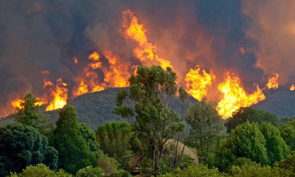
The Indian Air Force (IAF) has deployed its assets to aid the local administration in dousing the raging forest fire that started recently in Tamil Nadu's Nilgiris district.
What is a Forest Fire?
- A forest fire, also known as a wildfire, is an uncontrolled fire that occurs in forested areas or other vegetated landscapes.
- These fires can spread rapidly, fueled by dry vegetation, high temperatures, low humidity, and strong winds.
- Once ignited, they can quickly grow in size, consuming vast areas of land, vegetation, and wildlife habitat.
- Wildfires pose significant risks to human safety, property, ecosystems, and air quality.
Causes of Forest Fire:
- Forest fires are caused by Natural causes as well as man-made causes.
- Natural causes: Many forest fires start from natural causes such as lightning which sets trees on fire.
- However, rain extinguishes such fires without causing much damage. High atmospheric temperatures and dryness (low humidity) offer favorable circumstances for a fire to start.
- Man-made causes: Fire is caused when a source of fire like naked flame, cigarette or bidi, electric spark, or any source of ignition comes into contact with inflammable material.
- Natural causes: Many forest fires start from natural causes such as lightning which sets trees on fire.
Types of forest fire:
- Surface Fire: This type of forest fire spreads primarily along the ground, consuming surface litter such as dry leaves, twigs, and grasses.
- The flames engulf the forest floor as they advance.
- Underground Fire: Underground fires, also known as muck fires, burn with low intensity beneath the surface, consuming organic matter and surface litter.
- These fires often spread slowly and can continue burning for months, destroying vegetative cover.
- Ground Fire: Ground fires occur in sub-surface organic fuels such as duff layers under forest stands or organic soils of swamps.
- They burn herbaceous growth and organic matter beneath the surface, often transitioning from smoldering underground fires.
- Crown Fire: Crown fires involve the burning of the crowns of trees and shrubs, sustained by a surface fire.
- They are particularly hazardous in coniferous forests, where resinous material can fuel intense flames.
Frequency of Forest Fire in India:
- Seasonality: Forest fires in India are prevalent from November to June, with peak activity typically occurring in April and May, encompassing both small-scale and large-scale incidents.
- Vulnerability: The 2019 India State of Forest Report (ISFR) highlighted that over 36% of the country's forest cover is susceptible to frequent fires, with 4% categorized as extremely prone and an additional 6% as highly fire-prone.
- Affected Regions: Dry deciduous forests experience severe fires, with Northeast India, Odisha, Maharashtra, Jharkhand, Chhattisgarh, and Uttarakhand being particularly vulnerable areas.
- Recent Incidents: Notable fire outbreaks occurred in 2021 across Uttarakhand, Himachal Pradesh, Nagaland-Manipur border, Odisha, Madhya Pradesh, and Gujarat, including wildlife sanctuaries.
- In 2023, Goa faced large bushfires under investigation for potential human causes.
- 2024 Trends: Recent reports indicate heightened fire activity in Mizoram, Manipur, Assam, Meghalaya, and Maharashtra, with increased incidents along the Konkan belt, coastal Gujarat, southern Rajasthan, Madhya Pradesh, coastal Odisha, Jharkhand, Andhra Pradesh, Karnataka, and Tamil Nadu.
- Southern India: While Andhra Pradesh and Telangana witness fire incidents, forests in southern India, primarily evergreen or semi-evergreen, are less prone to fires, although Tamil Nadu has experienced recent wildfires.
Reasons Behind This Year's Fires:
- Climate Factors: Dry conditions, high temperatures, clear skies, and light winds have fueled forest fires in southern India.
- Temperature Trends: February 2024 was exceptionally hot, making it the hottest month in southern India since 1901.
- Heat Accumulation: Above-average temperatures over the past months led to a buildup of heat, drying out biomass in forests ahead of the summer season.
- Excess Heat Factor: Western Andhra Pradesh and Karnataka are experiencing higher-than-normal EHF values, increasing the risk of heat waves.
- Mild Aridity: Lack of rain and high temperatures have classified most districts in southern India as mildly arid.
Cabinet approves Flood Management and Border Areas Programme (FMBAP) for the period 2021-26
- 22 Feb 2024
Why is it in the News?
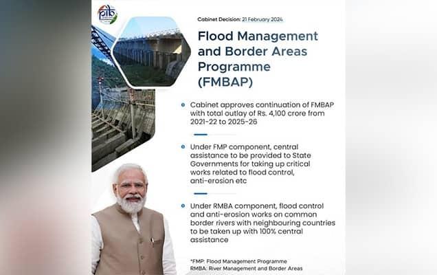
Recently, the Union Cabinet approved the continuation of “Flood Management and Border Areas Programme (FMBAP)” with a total outlay of Rs. 4,100 crore for a period of 5 years from 2021-22 to 2025-26.
About the Flood Management and Border Areas Programme (FMBAP):
- The FMBAP Scheme is being implemented throughout the country for effective flood management, erosion control and anti-sea erosion and to help in maintaining peace along the border.
- The scheme benefits towns, villages, industrial establishments, communication links, agricultural fields, infrastructure etc. from floods and erosion in the country.
- The catchment area treatment works will help in the reduction of sediment load into rivers.
- The Scheme aims at the completion of the ongoing projects already approved under FMP.
The Scheme has two components:
- Under the Flood Management Programme (FMP) component of FMBAP with an outlay of Rs. 2940 crore, central assistance will be provided to State Governments for taking up critical works related to flood control, anti-erosion, drainage development and anti-sea erosion, etc.
- The pattern of funding to be followed is 90% (Centre): 10% (State) for Special Category States (8 North-Eastern States and Hilly States of Himachal Pradesh, Uttarakhand and UT of Jammu & Kashmir) and 60% (Centre):40% (State) for General/ Non-Special Category States.
- Under the River Management and Border Areas (RMBA) component of FMBAP with an outlay of Rs. 1160 crore, flood control and anti-erosion work on common border rivers with neighbouring countries including hydrological observations and flood forecasting, and investigation & pre-construction activities of joint water resources projects (with neighbouring countries) on common border rivers will be taken up with 100% central assistance.
- The Scheme has the provision of incentivizing the States which implement flood plain zoning, recognized as an effective non-structural measure for flood management.
Importance:
- While the primary duty of flood management lies with the State Governments, the Union Government actively promotes and advocates for the adoption of modern technology and innovative approaches.
- Additionally, projects executed under the RMBA component serve to safeguard critical installations of security agencies and border outposts situated along border rivers from the perils of floods and erosion.
- Furthermore, the scheme includes provisions for incentivizing states that implement flood plain zoning, a recognized and effective non-structural measure for flood management.
