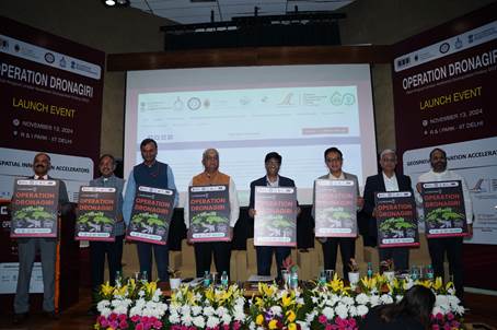
Operation Dronagiri

- 15 Nov 2024
In News:
- Recently, the Operation Dronagiri, launched under the National Geospatial Policy 2022 by the Department of Science and Technology (DST).
- Objective: It is a pilot project under India’s National Geospatial Policy 2022 aimed at showcasing the potential of geospatial technologies in sectors such as Agriculture, Livelihoods, and Logistics & Transport to improve quality of life and ease of doing business.
- Implementation:
- The first phase will cover five states: Uttar Pradesh, Haryana, Assam, Andhra Pradesh, and Maharashtra.
- Sectors Targeted: The focus will be on demonstrating the integration of geospatial data to solve real-world challenges in agriculture, transportation, and livelihoods.
National Geospatial Policy 2022
- Context: The National Geospatial Policy 2022 is aimed at liberalizing geospatial data and enabling widespread access and use of geospatial technologies across various sectors of governance, business, and development.
- Goals:
- Development of Geospatial Infrastructure: Promoting the creation of a robust infrastructure to make spatial data more accessible and usable.
- Geospatial Skill Development: Focus on creating a workforce proficient in geospatial technologies.
- Implementation of Standards: Establishing clear standards for geospatial data to ensure consistency and interoperability.
Role of Integrated Geospatial Data Sharing Interface (GDI)
- Launch: Alongside Operation Dronagiri, the Integrated Geospatial Data Sharing Interface (GDI) was also unveiled.
- Purpose: GDI is designed to facilitate seamless data sharing, access, and analysis of geospatial data.
- Key Features:
- Data Exchange: Enables smooth sharing of geospatial data for urban planning, disaster management, and environmental monitoring.
- Privacy and Security: Built with advanced data exchange protocols and privacy-preserving features to ensure secure data sharing.
- Collaboration: It will promote collaboration among stakeholders, including government agencies, industry, and startups, to unlock actionable insights for decision-making.
- Key Features:
Potential Applications of Geospatial Data
- Urban Planning: Assisting cities in designing efficient infrastructure.
- Disaster Management: Providing real-time data for better disaster response.
- Environmental Monitoring: Supporting initiatives for environmental protection and sustainability.
- Agriculture: Precision farming, crop monitoring, and improving supply chains.
- Logistics & Transport: Streamlining transportation networks, reducing traffic, and improving delivery systems.
Grand Challenge for Startups
- Objective: A Grand Challenge was announced as part of the initiative to support startups in developing Proofs of Concept (POCs) targeting specific problems in the focus sectors.
- Role of Startups: The challenge encourages innovation by early-stage and growth-stage startups in geospatial technology, offering mentorship, resources, and access to datasets.
- Geospatial Innovation Accelerators:
- The Geospatial Innovation Accelerators (GIAs) at prestigious institutions like IIT Kanpur, IIT Bombay, IIM Calcutta, and IIT Ropar will support this effort.
- Mentorship and Resources: These accelerators will provide the necessary support for startups to turn their innovations into scalable solutions.
Key Stakeholders and Operational Arms
- Geospatial Innovation Cell (DST): Responsible for overseeing the project’s implementation and execution.
- Navavishkar I-Hub Foundation (IITTNiF): Will manage the operational activities of Operation Dronagiri.
- Partnering Institutions: GIAs at IIT Kanpur, IIT Bombay, IIM Calcutta, and IIT Ropar will be the operational arms.
- Private Sector Involvement: Significant involvement of private sector companies, including startups, is crucial to ensuring the success and scalability of the project.
Impact and Significance
- Socioeconomic Benefits: The integration of geospatial data into agriculture, transport, and logistics will improve efficiency, reduce costs, and boost economic activity in critical sectors.
- Geospatial Innovation: The initiative marks a significant step towards making India a global leader in geospatial technology and positioning the country as a hub for innovative solutions using geospatial data.
- Government Engagement: The project will involve various government departments and corporates in a public-private partnership (PPP) model, similar to the successful implementation of the UPI payment system.
