Digital Crop Survey System (Indian Express)

- 19 Oct 2023
Why in the News?
Emphasizing the current manual nature of crop area and production estimation, the Central Government has urged states and Union Territories (UTs) to transition to a digital approach by implementing the Digital Crop Survey System starting in July next year.
About the Digital Crop Survey:
- As a part of the Digital Crop Survey initiative, the Ministry of Agriculture and Farmers Welfare (MoA&FW) has instructed states to capture data on essential parameters, encompassing:
- Village name, year, season, farmer ID, farm ID,
- Crop name (at the farm plot level),
- Crop variety,
- Crop sown area (at the farm plot level),
- Geotags of crop photos,
- Geotags of the farm boundary where the crop is cultivated,
- Sowing/planting date (at the farm plot level),
- Irrigation type (at the farm plot level), and
- Irrigation source (at the farm plot level).
- This directive follows the introduction of a pilot Digital Crop Survey across multiple states earlier this year.
- In a parallel initiative, the MoA&FW has also revised the release timelines for crop estimates.
- Previously conducted in five phases, the ministry has streamlined the process by eliminating the fourth phase traditionally released in August.
- The ministry now plans to unveil comprehensive final estimates encompassing all states and seasons (kharif, rabi, summer) in September-October, departing from the earlier practice of releasing final estimates in February of the subsequent year.
Guidelines for the Digital Crop Survey:
- According to sources, the Economics, Statistics and Evaluation Division (ESED) under the Ministry of Agriculture and Farmers’ Welfare (MoA&FW), has finalised the guidelines.
- According to the guidelines, all states/ UTs shall automate/digitise the process of area enumeration/girdawari of crops at field level, i.e., Digital Crop Survey, from 2024-25 Agricultural Year.
- In India, the agriculture year begins in July and ends in June, the following year.
- Under the guidelines, states and UTs shall use GPS-enabled mobile applications for collecting crop-sown data of each plot for each season and share the village-level aggregated data with DA&FW through API only.
Need for the Digital Crop Survey:
- The current methodology for gathering and consolidating crop statistics relies entirely on manual processes across most states, leading to delays and human errors in the data compilation.
- Only a handful of states, such as Karnataka, Telangana, and Andhra Pradesh, have embraced a digital approach to data collection through GPS-enabled mobile applications, particularly for the recording of crop area and Collection of Cost of Cultivation and Equipment Survey (CCEs) data directly from the fields.
- While Maharashtra and Madhya Pradesh have implemented digital systems, they are primarily focused on recording crop areas.
- India faces a challenge due to the lack of dependable agricultural production estimates, accentuating the necessity for a "real-time assessment estimate" of crops.
- Recognizing this gap, there is a compelling need to modernize the current production estimation system by incorporating technological interventions.
Organized Crime and Corruption Reporting Project (OCCRP) (The Hindu)

- 19 Oct 2023
Why in the News?
The Securities and Exchange Board of India (SEBI) has recently requested the Organized Crime and Corruption Reporting Project (OCCRP) to provide access to "essential documents" related to the accusations of stock manipulation and accounting fraud against the Adani Group.
About the Organized Crime and Corruption Reporting Project (OCCRP):
- The Organized Crime and Corruption Reporting Project (OCCRP) is a nonprofit investigative reporting platform that collaborates with over 50 independent media outlets worldwide, producing over 100 investigations annually.
- Established in 2006, its mission is to conduct transnational investigative reporting and advocate for technology-based approaches to expose organized crime and corruption on a global scale.
- The organization strives to cultivate and empower a global network of investigative journalists, publishing their stories to shed light on crime and corruption, enabling the public to hold those in power accountable.
Vision:
- OCCRP envisions a world where lives, livelihoods, and democracy are not jeopardized by crime and corruption.
- The organization is committed to exposing malfeasance so that the public can actively hold institutions accountable.
Core Initiatives:
- Global Investigative Network: OCCRP facilitates a global network of investigative journalists, providing them with essential resources and tools.
- This includes digital and physical security measures, enabling journalists covering sensitive topics to collaborate effectively with trusted editors.
- An investigative data platform, OCCRP Aleph empowers journalists to search and cross-reference over three billion records, unveiling criminal connections and patterns.
- This platform facilitates efficient cross-border collaboration among journalists.
- Training and Skill Development: OCCRP offers training programs to reporters and partners, equipping them with advanced journalism techniques, and enhancing their investigative capabilities.
- Partnerships for Change: OCCRP collaborates with advocacy groups, arming civil society with information to advocate for justice and transformative change.
- The organization also uncovers evidence that empowers law enforcement to take meaningful action.
Kati Bihu (PIB)

- 19 Oct 2023
Why in the News?
The Prime Minister, Narendra Modi recently extended best wishes on the auspicious occasion of KatiBihu to the people of Assam.
About Kati Bihu:
- Kati Bihu is an annual celebration observed in the state of Assam, signifying the relocation of rice saplings.
- The term "Kati" translates to cutting, representing the agricultural activity during this period.
- Also known as Kongali Bihu, with "Kongali" connoting a state of poverty, the festival holds cultural significance in Assam alongside two other Bihu festivals—Bhogali or Magh Bihu in January and Rongali or Bohag Bihu in April.
Significance:
- In this month, food resources are scarce, prompting people to celebrate by illuminating their homes with earthen lamps or candles.
- Lighting lamps near the Tulsi plant are a central aspect of the festival, signifying devotion and auspiciousness.
- People light a special lamp known as "Akash Banti" (Sky candle) in their paddy fields. Fueled by mustard oil, these lamps are elevated on bamboo poles.
- The belief prevails that the illuminated lamps guide the spirits of ancestors toward their heavenly abode.
Bhimashankar Temple (HT)
- 19 Oct 2023
Why in the News?
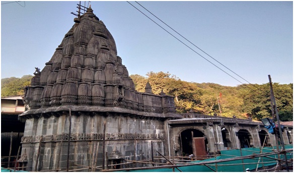
Tensions escalated at the Bhimashankar temple recently as a dispute unfolded between two groups of religious leaders, referred to as pujaris, regarding the leadership of the puja ceremony, leading to a brawl.
Bhimashankar Temple Overview:
- The Bhimashankar Temple is an ancient Hindu shrine dedicated to Lord Shiva, located amidst the Sahyadri hills in the Pune District of Maharashtra.
- Recognized as one of the 12 holy Jyotirlinga shrines in India, it holds immense spiritual significance.
- In recent times, it has gained additional importance as it was designated a "Wildlife Sanctuary," forming part of the Western Ghats and serving as the source of the Bhima River.
Historical Significance:
- Constructed around the 13th century, the temple is a testament to the craftsmanship of Vishwakarma sculptors.
- Subsequent enhancements, including the addition of spires (shikhara) by Maratha Empire statesman Nana Phadnavis in the 18th century, contribute to its historical evolution.
- Chhatrapati Shivaji Maharaj, the Maratha ruler, is believed to have played a role in fostering worship at the temple through his endowments.
Architectural Marvel:
- A blend of old and new structures in the Nagara style of architecture, the Bhimashankar Temple boasts spacious courtyards, intricate wall carvings, and imposing pillars.
- The sanctum, or Garbhgriha, houses the sacred Jyotirlinga, positioned at a lower level. The Swayambhoo, a self-emanated Shiv Linga, holds a central place in the Sanctum Sanctorum.
- Exquisite mythological carvings adorn the massive pillars and doorframes, depicting divine figures and sacred symbols.
- Additionally, the temple encompasses an ancient shrine dedicated to Lord Shani, considered auspicious by devotees, and features the revered Nandi statue at its entrance.
What are Jyotirlingas?
- Jyotirlingas are shrines where Lord Shiva is worshipped in the form of a Jyotirlingam, representing different manifestations of the deity.
- Among the 12 main Jyotirlingas in India, Bhimashankar Jyotirlinga is one.
- Each of these sacred shrines is named after its presiding deity and holds unique spiritual significance for devotees across the country:
- Somnath Jyotirlinga in Gir, Gujarat
- Mallikarjuna Jyotirlinga in Srisailam, Andhra Pradesh
- Mahakaleshwar Jyotirlinga in Ujjain, Madhya Pradesh
- Omkareshwar Jyotirlinga in Khandwa, Madhya Pradesh
- Baidyanath Jyotirlinga in Deoghar, Jharkhand
- Bhimashankar Jyotirlinga in Maharashtra
- Ramanathaswamy Jyotirlinga in Rameshwaram, Tamil Nadu
- Nageshwar Jyotirlinga in Dwarka, Gujarat
- Kashi Vishwanath Jyotirlinga in Varanasi, Uttar Pradesh
- Trimbakeshwar Jyotirlinga in Nasik, Maharashtra
- Kedarnath Jyotirlinga in Rudraprayag, Uttarakhand
- Ghrishneshwar Jyotirlinga in Aurangabad, Maharashtra
Siena Galaxy Atlas (SGA) (Space)

- 19 Oct 2023
Why in the News?
Astronomers have recently crafted a stunning atlas comprising 400,000 galaxies situated in the cosmic vicinity of the Milky Way, aptly named the Siena Galaxy Atlas.
About the Siena Galaxy Atlas:
- It is a digital atlas designed to help learn more about our universe by highlighting a number of well-known galaxies.
- It was produced using information gathered from three astronomical surveys conducted at Kitt Peak National Observatory (KPNO) and Cerro Tololo Inter-American Observatory (CTIO) between 2014 and 2017. These surveys collectively are referred to as the DESI Legacy Surveys.
Distinguishing Features:
- Setting itself apart from previous atlases, the Siena Galaxy Atlas relies on state-of-the-art digital images captured by advanced technology.
- Unlike its predecessors, which utilized outdated equipment and photographic plates, this atlas leverages highly sensitive instruments to produce the most precise and accurate data available.
- Notably, it marks the first cosmic atlas to showcase the light profiles of galaxies—a curve illustrating the variation in brightness from the galaxy's brightest point to its dimmest.
Significance:
- The introduction of the Siena Galaxy Atlas carries immense importance in astronomical exploration for several reasons:
- By relying on digital images captured with advanced instruments, the atlas ensures a level of precision and detail that surpasses previous methods, enhancing the overall quality of data.
- Light Profiles of Galaxies: A pioneering feature, the inclusion of light profiles in the atlas provides a unique perspective, allowing astronomers to glean valuable insights into the structure and characteristics of galaxies.
- Pattern Recognition: Cosmic atlases, such as the Siena Galaxy Atlas, play a pivotal role in aiding astronomers in identifying patterns.
- This capability is particularly valuable in categorizing phenomena like transient events, such as stars that exhibit sudden flares and then disappear.
- The atlas facilitates the identification of celestial objects worthy of more detailed follow-up studies, enabling astronomers to delve deeper into specific areas of interest.
- From unravelling the mysteries surrounding the birth and evolution of galaxies to investigating the distribution of dark matter and the propagation of gravitational waves through space, the Siena Galaxy Atlas serves as a versatile tool for astronomers in their cosmic pursuits.
AERA Warns Indian Airport Operators Against Charging Unapproved Tariffs (TOI)

- 13 Oct 2023
Why in the News?
The Airport Economic Regulatory Authority (AERA) issued a warning to major airports about levying aeronautical charges without approval.
About Airports Economic Regulatory Authority (AERA):
- Airports Economic Regulatory Authority (AERA), established under the Airports Economic Regulatory Authority of India Act, 2008, is a statutory body entrusted with the crucial task of regulating tariffs and associated charges for aeronautical services at major airports.
- This includes overseeing air traffic management, aircraft landing and parking, and ground handling services.
- The designation of an airport as "major" hinges on the 2008 Act, considering an annual passenger traffic threshold of at least 15 lakh.
- An amendment in 2019 elevated this criterion to 35 lakh annual passengers.
- For other airports, tariff determination falls under the purview of the Airports Authority of India (AAI).
- As an independent economic regulator, AERA operates with the objective of creating an equitable playing field, fostering healthy competition among major airports, promoting investment in airport facilities, and ensuring transparent regulation of aeronautical service tariffs.
- This initiative arose from the recognition of the need for an independent regulatory body capable of safeguarding the interests of both service providers and consumers.
- Headquartered in Delhi, AERA's history traces back to a time when most Indian airports were under the governance of the central government.
- The shift towards private sector participation in airport infrastructure development prompted the need for a distinct regulator.
- The Naresh Chandra Committee set up in 1997, recommended the establishment of an independent regulatory authority.
- Subsequently, the Airports Economic Regulatory Authority of India Act, 2008 (AERA Act), was enacted, leading to the creation of AERA.
About Airports Authority of India (AAI):
- Airports Authority of India (AAI), established through an Act of Parliament on April 1, 1995, resulted from the merger of the National Airports Authority and the International Airports Authority of India.
- Entrusted with a significant role, AAI is responsible for creating, upgrading, maintaining, and managing civil aviation infrastructure both on the ground and in the airspace of the country.
- Main Functions of AAI Include
- Construction, modification, and management of passenger terminals.
- Development and management of cargo terminals.
- Development and maintenance of apron infrastructure, encompassing runways, parallel taxiways, aprons, etc.
- Provision of Communication, Navigation, and Surveillance, involving DVOR / DME, ILS, ATC radars, visual aids, etc.
- Provision of air traffic services.
- Provision of passenger facilities and related amenities at its terminals.
Bihar’s Only Ramsar Site 'Kanwar Lake' Drying Up (DownToEarth)
- 13 Oct 2023
Why in the News?
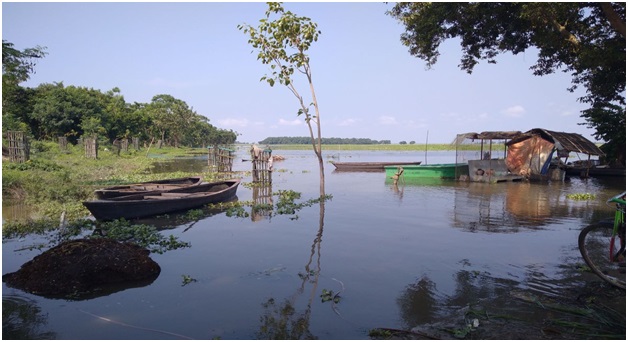
Bihar’s only wetland of international importance under the Ramsar Convention lies neglected and is on the brink of drying up, even as the state is pitching other waterbodies for classification.
About Kanwar Lake:
- Kanwar Taal, known as Kabar Taal or Kabartal Wetland, is an oxbow lake in Begusarai district, Bihar, India.
- It is the largest freshwater oxbow lake in Asia, covering an area of 67.5 km².
- The lake was established as a bird sanctuary in 1987 and is now a designated Ramsar site since 2020.
- Covering the majority of the Indo-Gangetic plains in northern Bihar, this lake was declared a Ramsar site in 2020, making it the first wetland in Bihar to be included in the Ramsar convention.
- Kanwar Taal is a significant wetland in Bihar and is an essential stopover for migratory waterbirds along the Central Asian Flyway.
- The lake provides vital flood absorption during the monsoon season and supports agriculture during the dry season.
- It also houses five critically endangered species and over 50 fish species.
- Biodiversity: Kanwar Taal is rich in biodiversity.
- It is home to a wide range of plant and animal species.
- It supports 165 plant species and 394 animal species, including 221 species of birds.
- These bird species include both resident and migratory birds, with the lake serving as an important stopover point for migratory waterbirds travelling along the Central Asian Flyway.
- Flood Absorption: The wetland plays a crucial role in flood absorption during the monsoon season.
- It helps in reducing the impact of floods in the region by absorbing excess water, which is important for flood control and the protection of nearby areas.
- Agricultural Support: During the dry season, Kanwar Taal supports agriculture in the surrounding areas.
- The water from the lake is used for irrigation, benefiting local farmers and contributing to the region's agricultural productivity.
- Endangered Species: The wetland is home to five critically endangered species, highlighting its significance in conserving rare and threatened wildlife.
- Additionally, it hosts over 50 fish species, contributing to the aquatic biodiversity of the region.
What are Oxbow Lakes?
- Oxbow lakes are crescent-like water bodies formed due to erosion and deposition in meanders of rivers.
- Meanders are loops or curved structures formed in the course of a river due to friction or tectonic activity.
- The speed of water flow in the outer section of this meander is more than the inner part causing its neck to become narrower over time.
- Eventually, the size of this loop increases making it harder for the river to flow through it so it opts for a straight path.
- Finally, the ends of this meandered loop are separated by deposition of sediments or silt separating the river and a horseshoe-like structure called oxbow lake.
Data Analytics Dashboard” and “Poorvottar Sampark Setu” Portal Launched (PIB)
- 13 Oct 2023
Why in the News?
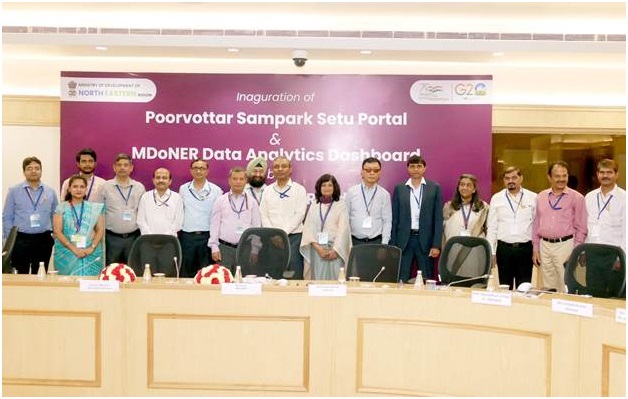
The Union Ministry of Development of the North-East Region virtually launched the “MDoNER Data Analytics Dashboard” and “Poorvottar Sampark Setu” portal at Vigyan Bhawan, New Delhi recently.
About Poorvottar Sampark Setu Portal:
- The Poorvottar Sampark Setu portal is a robust tool designed to streamline and improve the monitoring of Union Ministers' fortnightly visits to the North Eastern Region (NER)
Key features include:
- Insightful Dashboard: The portal offers a comprehensive dashboard presenting valuable insights and graphical information on state-wise/district-wise visits to NER by Union Ministers, serving as a centralized resource for stakeholders.
- Curated Minister List: It generates a curated list of Ministers eligible for nomination for visits to NER in the upcoming months, facilitating efficient planning.
- Online Tour Reporting: After their visit, Ministers can conveniently submit tour reports and recommendations online, streamlining the reporting process.
- Recommendation Analysis: MDoNER (Ministry of Development of North Eastern Region) can analyze and forward the received recommendations to respective line Ministries, Departments, and State Governments for prompt action.
- Summary Report Generation: The portal offers a one-click summary report generation feature, simplifying the overview of visits for effective decision-making.
What is the MDoNER Data Analytics Dashboard?
- The MDoNER Data Analytics Dashboard is a comprehensive platform integrating data from 112 schemes across 55 Departments and Ministries.
Its key benefits include:
- Data-Driven Decision Making: Empowers stakeholders with data-driven insights for informed decision-making.
- Operational Efficiency: Streamlines operations, ensuring a seamless and efficient workflow.
- Centralized Monitoring: Provides a centralized hub for monitoring diverse schemes and initiatives.
- Policy-Level Decision Tool: Functions as a valuable tool for crafting policies based on robust data analysis.
- Information Integration: Integrates information seamlessly, fostering coherence and accessibility.
- Focused Monitoring: Keeps a vigilant eye on NER Aspirational districts, North East border districts, and the most backward districts in NER for targeted interventions.
Modi’s Visit to Gunji Irks Nepal Opposition (Indian Express)
- 13 Oct 2023
Why is it in the News?
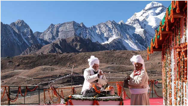
Prime Minister Narendra Modi’s visit to Gunji near Kalapani, Uttarakhand has triggered an uproar in Nepal.
About Gunji Village:
- Gunji Village, situated in the Dharchula tehsil of Pithoragarh district in northern Uttarakhand, holds a strategic location near the borders of Tibet and Nepal.
- Nestled at an altitude of 3500 meters, it marks the confluence of the Kuthi Yankti and Kalapani Rivers at the eastern end of the Kuthi Valley, offering stunning views of Mount Api in Nepal.
- Covering a geographical area of 188.9 hectares, Gunji is a seasonal abode for its inhabitants.
- During winters, the residents, totalling 335 people in 194 households as per the 2011 census, migrate to lower altitudes, primarily to Dharchula within the same district.
- The village is under the administration of a Sarpanch, the elected head.
- Renowned for its connection to the traditional Indian/Nepalese route to Kailas–Manasarovar, Gunji attracts visitors seeking its breathtaking vistas.
- To embark on a journey to Gunji, obtaining an Inner Line permit is a prerequisite.
What is an Inner line permit (ILP)?
- An Inner Line Permit (ILP) is an official travel document issued by the Government of India, facilitating the inward travel of Indian citizens into a protected area for a limited duration.
- It is mandatory for Indian citizens residing outside these specific states to secure a permit before entering the designated state.
- This document serves as a regulatory measure by the government to manage and monitor the movement of individuals into areas located in proximity to India's international borders.
- The concept originates from the Bengal Eastern Frontier Regulations of 1873, designed to safeguard the Crown's interests in trades such as tea, oil, and elephants by restricting the entry of "British subjects" into these designated "Protected Areas.
- In 1950, the term "British subjects" was replaced by "Citizen of India."
- ILPs come in various types, including those for tourists and others intended for individuals planning extended stays, often for employment purposes.
CSIR-CCMB Study to Understand the Genetics Behind Diseases (The Hindu)

- 13 Oct 2023
Why in the News?
The project — “Diverse Epigenetic Epidemiology Partnership (DEEP)” — aims to uncover the effects of genomic and environmental diversity on disease risk observed in people across the world, including those in Asia, Africa and North and South America.
About the Project, The Diverse Epigenetic Epidemiology Partnership (DEEP):
- The Diverse Epigenetic Epidemiology Partnership (DEEP) is a pioneering genomics and epigenomics initiative aimed at unravelling the genetic underpinnings of Non-Communicable Diseases (NCDs) in diverse populations, including South Asians.
- This five-year international project seeks to illuminate the impact of genomic and environmental diversity on disease risk across global populations, spanning Asia, Africa, and North and South America.
- Researchers will examine individuals from varied genetic and environmental backgrounds, analyzing DNA methylation patterns to discern their contributions to disease risk within each context.
- The study involves the development of software, infrastructure, and advanced statistical analyses to create new resources, integrated with existing international health and genetics databases for assessing trends in DNA methylation variation.
- This initiative holds significance as it aims to identify common and region-specific disease-causing mechanisms, addressing questions about the universal effectiveness of medicines and paving the way for targeted interventions to reduce global health disparities.
What is DNA methylation?
- DNA methylation is a molecular process involving the attachment of chemical groups to DNA, influencing the activation and deactivation of genes.
- This epigenetic modification plays a crucial role in enabling the body to respond to environmental signals, thereby contributing to overall systemic health and disease status.
- The intricate interplay between DNA methylation, genetics, and the environment is essential for unravelling the pathways that underlie health and disease, providing insights into their interconnected consequences.
DGCA Implements New Rules for Hang Gliders (Business Standard)

- 18 Oct 2023
Why in the News?
Aviation regulator DGCA has issued amended norms for operating powered hang gliders in the country.
About Hang Gliders:
- A hang glider is a distinctive type of aircraft that relies on air currents to remain airborne, setting it apart from conventional aircraft with engines and propellers.
- These aerodynamic marvels depend on wind dynamics for lift rather than propulsion.
- Operational Mechanics: Due to their unpowered nature, hang gliders necessitate launching from elevated points such as hills or mountains.
- Gravity, acting as the primary force, encompasses the weight of both the pilot and the wing.
- This weight generates thrust, propelling the aerofoil through the air.
- The aerofoil's distinctive shape prevents the hang glider from descending rapidly and facilitates lift.
- The aerofoil's design manipulates airflow, compelling the air above the wing to move faster, creating a low-pressure area.
- Simultaneously, the wing's downward and forward motion compresses the air beneath, fostering lift as the aerofoil is drawn into the low-pressure zone.
- Pilots maintain control during flight by manipulating the trapeze and adjusting direction and speed.
- Powered Hang Gliders: In a departure from traditional hang gliders, powered hang gliders integrate features of both hang gliders and powered aircraft.
- Equipped with a small engine, these variants enable pilots to take off and sustain flight without relying on natural elements like thermals or wind conditions, making them accessible to less-experienced aviators.
DGCA Regulations for Powered Hang Gliders:
The Directorate General of Civil Aviation (DGCA) mandates strict regulations governing powered hang gliders:
- Operation Authorization: Individuals must obtain prior authorization from a DGCA-approved examiner or instructor before operating a powered hang glider.
- Examiner Qualifications: Approved examiners must possess a minimum of 50 hours of experience on powered hang gliders, including at least 10 hours on a dual machine.
- Test Flight Criteria: Individuals conducting test flights must meet specific criteria, holding a valid Commercial Pilot Licence (CPL) with at least 25 hours of flying experience on a powered hang glider or authorization with 50 hours of flying experience.
- Transaction Certification: The sale or transfer of a powered hang glider requires a DGCA-issued certificate following a background check conducted by the Ministry of Home Affairs (MHA).
- Lease and Operation Restrictions: Owners or operators are prohibited from leasing, renting, or lending powered hang gliders.
- The use of certain equipment and devices is strictly regulated, with explicit permissions required.
- Safety Protocols: Security measures endorsed by the Bureau of Civil Aviation Security (BCAS) are obligatory at parking and operational locations, ensuring compliance with established guidelines for safe flight operations.
Is Halley’s Comet returning? (India Today)
- 18 Oct 2023
Why in the News?
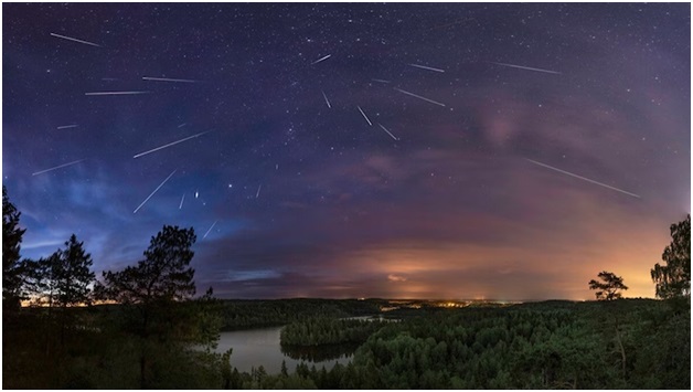
The celestial calendar for 2023 is set to offer a spectacular show as the Orionid meteor shower is expected to rain down its greatest number of meteors on the mornings of October 21 and 22.
About the Orionid Meteor Shower:
- An annual celestial spectacle illuminating the night sky every October, the Orionid meteor shower is a captivating phenomenon with a fascinating origin.
- This cosmic event transpires as Earth traverses the remnants of debris left by Halley's Comet, officially designated as 1P/Halley.
- Halley's Comet, on a roughly 76-year orbit around the sun, sheds dust particles from its nucleus during each passage through the inner solar system.
- This process creates a distinctive trail of debris along its path.
- In late October each year, Earth intersects this celestial trail, giving rise to the mesmerizing display known as the Orionid meteor shower.
- Measuring about five by nine miles in size, Halley's Comet undergoes a remarkable transformation, losing between three to ten feet of material with each journey through the inner solar system.
- The resulting debris becomes the source of the Orionid meteors.
- This celestial event offers a visual treat for observers in both the Northern and Southern hemispheres, particularly during the post-midnight hours.
- It provides an opportunity to witness the graceful streaks of light as the meteors traverse the night sky.
What are Meteors?
- Meteors, often referred to as "shooting stars," are a captivating manifestation of meteoroids entering Earth's atmosphere at high speed and subsequently burning up.
- Meteor showers, occurring annually or at regular intervals, are linked to the Earth passing through the dusty debris trail left behind by a comet.
- In the case of the Orionid meteor shower, the meteors are named after the constellation Orion, close to where these luminous streaks appear in the sky.
- This annual celestial event not only captivates observers with its dazzling display but also serves as a reminder of the dynamic interactions between Earth and the celestial bodies that grace our cosmic neighbourhood.
Microalgae are Adapting to Warming Climate (DownToEarth)

- 18 Oct 2023
Why in the News?
A recent study finds microalgae are firing up a light-responsive protein to use sunlight for growth.
What is the Microalgae?
- Microalgae are microscopic algae prevalent in freshwater and marine environments, consisting of unicellular species that can exist independently or in chains and groups.
- Comprising unicellular algal varieties such as green algae, diatoms, and dinoflagellates, these organisms exhibit sizes ranging from a few micrometres to several hundred micrometres.
- Their colour, determined by predominant pigments, categorizes them into groups like green, red, or brown.
- Unlike higher plants, microalgae lack roots, stems, or leaves, and they predominantly engage in photosynthesis, fueled by photosynthetic pigments.
- Heterotrophic microalgae, lacking these pigments, rely on other organisms for sustenance.
Significance:
- Microalgae play a foundational role in the aquatic food chain, offering vital nutrients for zooplankton, small fish, and various aquatic organisms.
- They serve as a primary food source for filter-feeding organisms.
- Moreover, photosynthetic microalgae contribute significantly to global carbon and oxygen cycles, absorbing carbon dioxide and generating oxygen through photosynthesis.
- Approximately half of atmospheric oxygen is produced by these organisms.
- Microalgae can also establish symbiotic relationships, as seen in their association with corals (zooxanthellae), providing nutrients through photosynthesis.
- Certain microalgae, like Nostoc, Anabaena, and Oscillatoria, exhibit nitrogen-fixing capabilities.
- Additionally, microalgae are rich in nutrients and can be consumed by humans. Notable examples like Spirulina and Chlorella are often utilized as dietary supplements.
What are Macroalgae?
- Macroalgae, commonly known as seaweeds, are marine plants engaging in photosynthesis but reproducing without flowers.
- Visible to the naked eye, in contrast to microalgae, they typically grow attached to the seabed or reef substrate.
- These macroscopic algae play crucial roles in reef ecosystems, providing both food and habitat for a diverse array of species while contributing significantly to nutrient dynamics.
Diphtheria Outbreak in Guinea (WHO)

- 18 Oct 2023
Why in the News?
The World Health Organization (WHO) has announced that Guinea's Health Ministry has officially notified them of a diphtheria outbreak.
What is Diphtheria?
- Diphtheria, an extremely contagious and infectious disease, instigates severe inflammation in the nose, throat, and trachea (windpipe).
- This ailment is caused by strains of bacteria known as Corynebacterium diphtheriae, which produce a potent toxin responsible for the onset of illness.
Causes:
- The bacterial infection spreads through various means, including respiratory droplets emitted during coughing or sneezing.
- Transmission can also occur through contact with infected open sores or ulcers. The bacteria's toxin is the primary culprit behind the illness.
Symptoms:
- Manifesting 2-5 days post-infection, symptoms of diphtheria encompass a thick, grey membrane covering the throat and tonsils, a sore throat, hoarseness, swollen glands in the neck, difficulty breathing, nasal discharge, fever, chills, and fatigue.
- If the toxin enters the bloodstream, it can lead to damage to the heart, nerves, and kidneys.
Infection and Spread:
- Diphtheria bacteria thrive on person-to-person transmission, emphasizing respiratory droplets as a common mode of contagion.
- Skin infections are possible but seldom result in severe disease.
Treatment:
- Combatting diphtheria involves a dual-pronged approach:
- Antitoxin (Anti-diphtheritic Serum): This neutralizes bacterial toxins and is specifically employed for respiratory system infections. The antitoxin acts on toxins that haven't bound with cells and tissues.
- Antibiotics (Erythromycin or Penicillin): These medications eradicate the bacteria, preventing further spread. Antibiotics are effective against both the respiratory system and skin infections caused by diphtheria.
RISC-V Technology (The Hindu)

- 18 Oct 2023
Why in the News?
Chip designer Qualcomm said on Tuesday it is partnering with Alphabet's Google to make wearable devices like smartwatches using chips based on RISC-V technology.
What is RISC-V Technology?
- RISC-V technology, colloquially pronounced as "risk five," stands as a pioneering open-source initiative in computer architecture.
- Functioning as an open-source Instruction Set Architecture (ISA), it serves as the foundation for crafting customized processors tailored to various end applications.
- Positioned as the fifth generation of processors rooted in the Reduced Instruction Set Computer (RISC) philosophy, RISC-V originated as a project at UC Berkeley.
- Initially conceived for academic purposes, it has since matured into a robust standard now overseen by RISC-V International.
- RISC-V operates as an open-standard architecture, with its definition shaped collaboratively by member companies associated with RISC-V International—a global nonprofit organization steering the ISA.
- This collaborative approach fosters innovation and design freedom among member companies, paving the way for groundbreaking advancements in processor technology.
- At its core, RISC-V features a concise set of instructions upon which all software designs run.
- This streamlined architecture empowers designers to tailor and construct processors in alignment with the specific requirements of their intended applications.
Key Advantages:
- The merits of RISC-V extend beyond its technical specifications. Its open-standard nature facilitates industry-wide collaboration and innovation, enabling diverse stakeholders to contribute to the evolution of processor technology.
- Moreover, the entire RISC-V architecture is subject to scrutiny in the public domain, mitigating concerns related to back doors and concealed channels.
Applications:
- RISC-V finds application across a broad spectrum of industries, including wearables, industrial processes, Internet of Things (IoT), home appliances, smartphones, automotive systems, high-performance computing (HPC), and data centres.
- Its versatility makes it a compelling choice for diverse technological landscapes, showcasing its adaptability and efficacy across various domains.
Forest Department Relies on Muthuvan Tribe's Indigenous Knowledge for Nilgiri Tahr Conservation (The Hindu)
- 17 Oct 2023
Why in the News?
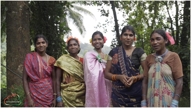
Members of the Muthuvan tribe of the Anamalai hills, who are known for coexisting with the wildlife with their traditional knowledge, have joined hands with the Tamil Nadu Forest Department for a unique task.
About the Muthuvan Tribe:
- Inhabiting the border hill forests of Kerala and Tamil Nadu, the Muthuvan tribe is distributed across this region.
- The tribe communicates in distinct dialects, identifying themselves as Malayalam Muthuvan and Pandi Muthuvan.
- Cultural Beliefs: Embracing animism and spirit worship, the Muthuvan tribe venerates forest gods and attributes the spirits of their ancestors as the initial settlers in the hill forests.
- Renowned for their harmonious coexistence with wildlife, the Muthuvan people leverage traditional knowledge to navigate their relationship with the natural environment.
- Unique Governance System - 'Kani System': Operating under the 'Kani System,' each village is overseen by a 'Kani' responsible for village administration, reflecting their distinctive form of governance.
- Traditional Medicine Expertise: Proficient in traditional medicines, the Muthuvan tribe safeguards their effective remedies, preserving and passing down this knowledge across generations.
- Occupation: Agriculture serves as the primary occupation for Muthuvan tribes, yielding various products such as ragi, cardamom, and lemongrass.
About Project Tahr:
- Project Tahr aims to enhance comprehension of the Nilgiri Tahr population through surveys and radio telemetry studies.
- The initiative focuses on reintroducing Tahrs to their historical habitat, fostering their return to natural landscapes.
- Addressing immediate threats, the project employs strategic measures to mitigate challenges facing the Nilgiri Tahr.
- A key component involves intensifying public awareness efforts to garner support and understanding for the conservation of this species.
- Project Tahr is slated for a comprehensive 5-year implementation, spanning from 2022 to 2027.
INS Sumedha Visits Nigeria as part of its deployment to the Gulf of Guinea (PIB)

- 17 Oct 2023
Why in the News?
Indian Naval Ship INS Sumedha recently made a port visit at Lagos, Nigeria as part of its deployment to the Gulf of Guinea (GoG).
About INS Sumedha:
- INS Sumedha is the third vessel among the indigenously crafted Saryu-class Naval Offshore Patrol Vessels (NOPV).
- Constructed and designed domestically, Goa Shipyard Limited played a pivotal role in the indigenous creation of INS Sumedha.
- The vessel officially joined the Indian Navy's fleet on March 7, 2014.
- Operational Base: A key asset of the Indian Navy's Eastern Fleet, INS Sumedha operates from its base in Visakhapatnam.
- Primary Functions: The vessel is tasked with a diverse range of functions, including EEZ surveillance, anti-piracy patrols, fleet support operations, maritime security provision to offshore assets, and execution of escort operations for high-value assets.
- Features:
- With a displacement of 2,230 tonnes, INS Sumedha boasts dimensions of 105 meters in length and 12.9 meters in beam.
- Equipped with a cutting-edge weapon and sensor package, the vessel ensures enhanced operational capabilities.
- Designed to carry an Advanced Light Combat Helicopter onboard, adding to its versatility in maritime operations.
- Powered by two of the largest diesel engines deployed in the Indian Navy, INS Sumedha attains a top speed of 25 knots.
- Featuring a remarkable range of 6,000 nautical miles (11,000 km) at 16 knots (30 km/h), the offshore patrol vessel is well-suited for prolonged missions and operations.
About the Gulf of Guinea:
- Location: Situated as the northeasternmost part of the tropical Atlantic Ocean, the Gulf of Guinea is positioned off the western coast of the African continent.
- The Gulf lies at the confluence of the Prime Meridian and the Equator, specifically at 0°0’N and 0°0'E.
- Extent and Coastline: Encompassing an area of 2.3 million square kilometres, the Gulf features an extensive coastline stretching approximately 6,000 kilometres.
- Characterized by a narrow continental shelf, it boasts a distinctive coastal landscape.
- Oceanic Conditions: The Gulf of Guinea experiences warm tropical waters characterized by relatively low salinity, influenced by the inflow of rivers and high regional rainfall.
- Notable tributaries include the Volta and Niger rivers.
- Coastal Countries: 16 countries border the Gulf of Guinea, including Angola, Benin, Cameroon, Cote d'Ivoire, Democratic Republic of Congo, Republic of Congo, Guinea, Equatorial Guinea, Guinea-Bissau, Gabon, Nigeria, Ghana, São Tomé and Principe, Togo, and Sierra Leone.
- Topography: The coastal region is predominantly low-lying, featuring mangrove swamps, marshes, and lagoons.
- Geological Significance: The Gulf's coastline bears a striking resemblance to the continental margin of South America, affirming the theory of continental drift.
- Holding over 35% of the world’s petroleum reserves, the Gulf of Guinea is a significant global repository of petroleum.
- Security Challenges: Regrettably, the Gulf of Guinea has gained notoriety as one of the world’s most perilous gulfs due to widespread piracy, significantly impacting West African countries and attracting international concern.
BCCC Cautions Entertainment Channels on Depicting SCs, STs. (Business Standard)

- 17 Oct 2023
Why in the News?
The Broadcasting Content Complaint Council (BCCC) on Tuesday asked entertainment channels to exercise "extreme caution" while portraying the scheduled castes and scheduled tribes in television programmes to avoid hurting the sentiments of the members of the two communities.
About the Broadcasting Content Complaints Council (BCCC):
- The Indian Broadcasting and Digital Foundation (IBDF) established the BCCC in June 2011 as an independent self-regulatory body.
- Regulatory Role: The primary function of the BCCC is to enforce self-regulatory guidelines for non-news channels, covering general entertainment, kids, and special interest channels.
- Formulation of Guidelines: Guidelines address crucial areas, including national interest, racial and religious harmony, treatment of children, social values, explicit content (sex and nudity), violence, crime, gambling, drugs, smoking, tobacco, alcohol, defamation, harm, and offence.
- Complaint Lodging Process: Any viewer can file a complaint regarding television programs, non-news channels, and digital content of IBDF India members.
- Composition of BCCC:
- The council comprises 13 members, including a chairperson, four non-broadcast members, four representatives from national-level statutory commissions, and four members from the broadcast industry.
- Functioning Mechanism: Upon receiving a valid complaint, the concerned channel is required to present its viewpoint on the contested content within one working week.
- If the BCCC committee finds the channel's response unsatisfactory, it holds the authority to issue directives, mandating modifications or withdrawal of the content.
- Reporting to Authorities: In case of non-compliance with directives, the BCCC promptly submits a detailed report to the Ministry of Information and Broadcasting within 24 hours.
Key Details about the Indian Broadcasting & Digital Foundation (IBDF):
- Founded in 1999, the Indian Broadcasting Foundation initially served as the apex body for broadcasters.
- Recently rebranded as the Indian Broadcasting and Digital Foundation (IBDF) to encompass digital platforms, consolidating oversight over all digital over-the-top streaming firms.
- Representative Role: Recognized as the official spokesperson for the Indian broadcasting industry, IBDF plays a crucial role in articulating industry perspectives.
- IBDF's membership includes a diverse range of channels, covering both news and non-news categories such as General Entertainment Channels (GEC), sports, music, movies, and infotainment.
- Actively involved in providing research-based legislative inputs to the government, IBDF engages in advocacy efforts on various fronts, including fiscal, regulatory, and business issues.
- The organization plays a pivotal role in facilitating the formulation of favourable policies, addressing industry challenges, and advocating for essential changes in the overall system.
New Plant Species Curcuma kakchingense Discovered in Manipur (HT)

- 17 Oct 2023
Why in the News?
In a remarkable botanical discovery, a team of researchers from the Department of Life Sciences at Manipur University and Kwaklei and Khonggunmelei Orchids Pvt. Ltd. has unveiled a hitherto unknown plant species named "Curcuma kakchingense."
About Curcuma Kakchingense:
- Recently identified flowering plant species in Manipur, belong to the Zingiberaceae family.
- Member of the angiospermic family Zingiberaceae, which includes well-known plants like turmeric, gingers, and cardamom.
- Plant Characteristics: Robust plant reaching a height of eight feet, characterized by large terminal inflorescence.
- Natural Habitat: Thrives along the banks of the Sekmai River in the Kakching District of Manipur.
- Resemblance to Other Species: Bears a striking resemblance to local "Yaingung" (Curcuma longa) and Curcuma phrayawan from Thailand.
- Distinguished by lemon-yellow rhizomes with a notably bitter taste.
- IUCN Red List Classification: Classified as "Data Deficient" (DD) under the IUCN Red List category.
Importance of Curcuma Plants:
- Culinary and Traditional Uses: Various Curcuma species, including turmeric (Curcuma longa), play a vital role in cuisines, traditional medicines, spices, and dyes.
- Biological Activities: Curcumin and curcuminoids found in Curcuma species are nontoxic polyphenolic compounds with diverse biological activities.
- Pharmacological Properties: Essential oil of Curcuma species possesses pharmacological properties, including anti-inflammatory, anti-cancerous, anti-diabetic, and anti-microbial effects.
- Versatile Applications: Widely utilized in cosmetics, perfumes, and as ornamental plants, contributing to various industries and daily life.
New Artificial Intelligence System BTSbot Discovers Supernova (India Today)

- 17 Oct 2023
Why in the News?
An international team led by Northwestern University has successfully created an artificial intelligence (AI) tool Bright Transient Survey Bot (BTSbot) that can detect, identify, and classify supernovae.
What is the Bright Transient Survey Bot (BTSbot)?
- The Bright Transient Survey Bot operates as a machine-learning algorithm, undergoing training with a vast dataset comprising over 1.4 million images from nearly 16,000 sources.
- Utilizing data from the Zwicky Transient Facility (ZTF), it successfully identified the recently discovered supernova named SN2023tyk.
- Functionality: The algorithm seamlessly automates the process of seeking potential supernovae across the night sky.
- In the case of SN2023tyk, it autonomously requested the supernova's spectrum from the Palomar Observatory.
- Subsequently, the Spectral Energy Distribution Machine (SEDM), another robotic telescope, performed comprehensive observations to obtain the source's spectrum.
- Advantages: This innovative system not only streamlines the entire workflow of searching, detecting, confirming, classifying, and announcing new supernovae but also eradicates human error, significantly enhancing the speed of the process.
- The Bright Transient Survey Bot showcases the potential of automated technology in advancing astronomical discoveries.
What is artificial intelligence?
- Artificial Intelligence (AI) refers to the interdisciplinary field of computer science dedicated to developing algorithms and computational models that emulate human cognitive processes.
- Rooted in machine learning and advanced data analytics, AI aims to create systems capable of reasoning, problem-solving, and decision-making.
- AI involves the study and design of intelligent agents, encompassing areas like natural language processing, computer vision, and expert systems.
- It seeks to enhance machines' ability to learn from experience, adapt to new information, and perform tasks that traditionally necessitate human intelligence, fostering innovation across diverse domains, including healthcare, finance, and robotics.
Chennai's Pallikaranai Wetlands Welcoming Migratory Bird Flocks (The Hindu)
- 16 Oct 2023
Why in the News?
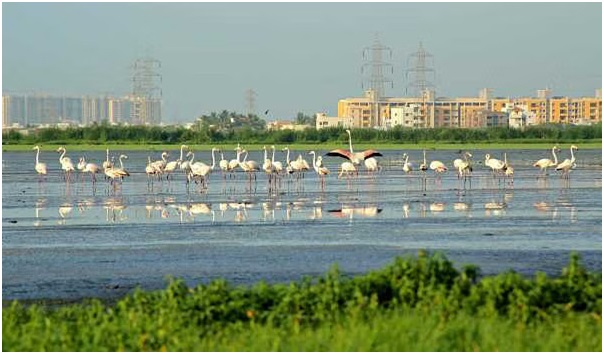
With over 150 garganeys, and several other species, including waders and raptors, flocking the Pallikaranai marshland, the curtain for the migratory season has been raised.
About Pallikaranai Marshland:
- Location: Pallikaranai marshland is a freshwater and partly saline wetland, located approximately 20 kilometres south of Chennai, Tamil Nadu.
- The eastern border of the marsh is flanked by the Buckingham Canal.
- Rich Ecosystem: The diverse ecosystem of Pallikaranai supports an impressive array of wildlife, including 115 bird species, 10 mammals, 21 reptiles, 10 amphibians, 46 fish, nine molluscs, five crustaceans, and seven butterfly species.
- Notable Species: Among the diverse wildlife are noteworthy species such as the Russell’s viper (Daboia siamensis), glossy ibis (Plegadis falcinellus), grey-headed lapwings (Vanellus cinereus), and Pheasant-tailed jacana (Hydrophasianus chirurgus).
- Biodiversity Significance: Beyond its biodiversity, the marshland serves a crucial role in flood prevention for Chennai, absorbing water during wet periods and releasing it during dry spells.
- Environmental Threats: Despite its ecological importance, the site faces threats from invasive non-native species, household sewage, urban wastewater, and periodic droughts.
- Ramsar Designation: Acknowledging its ecological significance, Pallikaranai marshland holds the status of being one of India's Ramsar sites, recognized for its importance in wetland conservation on an international scale.
INS Beas to Be Upgraded (PIB)

- 16 Oct 2023
Why in the News?
The Ministry of Defence signed a contract on October 16, 2023, in New Delhi for the life Upgrade and Re-Powering of "INS Beas" with Kochi-based M/S Cochin Shipyard Limited (CSL) at an overall cost of Rs. 313.42 Cr.
Context:
- The INS Beas is gaining attention as the first Brahmaputra Class Frigate to undergo a transition from steam to diesel propulsion.
- The completion of its Mid-Life Upgrade and Re-Powering in 2026 is expected to result in the INS Beas joining the active fleet of the Indian Navy, equipped with a modernized weapon suite and upgraded combat capabilities.
About INS Beas:
- INS Beas (F37) stands as a Brahmaputra-class frigate within the Indian Navy, constructed at the Garden Reach Shipbuilders and Engineers (GRSE) in Kolkata.
- Commissioned on July 11, 2005, it is the second ship in the Indian Navy to carry this name, with the first being a Leopard-class frigate commissioned in 1960 and decommissioned in 1992.
- Role: Functioning as a versatile warship, INS Beas is proficient in various missions, encompassing anti-aircraft, anti-submarine, and anti-ship warfare.
- Additionally, it plays a crucial role in patrolling, surveillance, and safeguarding India's maritime interests.
- Features: The ship's design and construction are wholly Indian, derived from the modification of the Godavari-class frigate.
- With a displacement of about 3,850 tonnes, INS Beas boasts a length of 126 meters (413 feet) and a beam width of 14.5 meters (48 feet).
- Propulsion: Powered by 2 steam turbines, INS Beas demonstrates remarkable agility, capable of reaching speeds exceeding 30 knots during naval operations.
- Technology: Equipped with modern sensor suites and matching weapon systems, the ship embodies cutting-edge technology to enhance its operational capabilities.
Amazon River Hits Lowest Levels in a Century Amid Drought in Brazil (Business Standard)
- 16 Oct 2023
Why in the News?
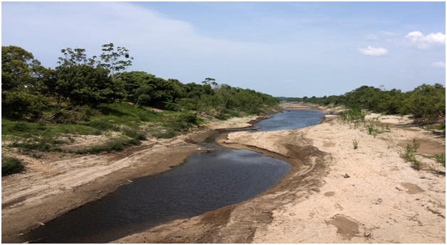
The Amazon River fell to its lowest level in over a century on Monday at the heart of the Brazilian rainforest as a record drought upended the lives of hundreds of thousands of people and damaged the jungle ecosystem.
About the Amazon River:
- The Amazon River holds the distinction of being the world's largest river in terms of both water volume and width.
- Length and Course: Spanning an impressive 6,400 kilometres, it is the second-longest river globally, surpassed only by the Nile.
- Originating high in the Andes Mountains, the river courses its way eastward through vast rainforests and lowlands before reaching its culmination at the northeastern coast of Brazil, where it empties into the Atlantic Ocean.
- Dynamic Width: During the dry season, the Amazon River exhibits a width ranging from 4 to 5 kilometres, expanding significantly to 50 kilometres in certain areas during the wet season.
- Unparalleled Drainage Area: The Amazon boasts the largest drainage area globally, with its watershed spanning across Brazil, Peru, Ecuador, Colombia, Venezuela, and Bolivia.
- Approximately two-thirds of the Amazon's mainstream and the majority of its basin lie within the borders of Brazil.
- Water Discharge and Global Impact: With a staggering water discharge of 300,000 cubic meters per second into the Atlantic Ocean, the Amazon contributes one-fifth of the total freshwater volume entering the world's oceans.
- This immense water flow plays a pivotal role in regulating global oxygen and carbon cycles.
- Extensive Tributaries: Featuring over 1,100 tributaries, including seventeen exceeding 1,500 kilometres in length, notable contributors include the Rio Negro, the Madeira River, and the Xingu River.
- Environmental Significance: The Amazon Rainforest, constituting approximately half of the Earth's remaining rainforest, stands as the largest repository of biological resources.
- Often referred to as the "lungs of the Earth," the Amazon plays a crucial role in maintaining the planet's oxygen and carbon balance.
US Says Egypt Border Crossing to Gaza to Reopen (Business Today)
- 16 Oct 2023
Why in the News?
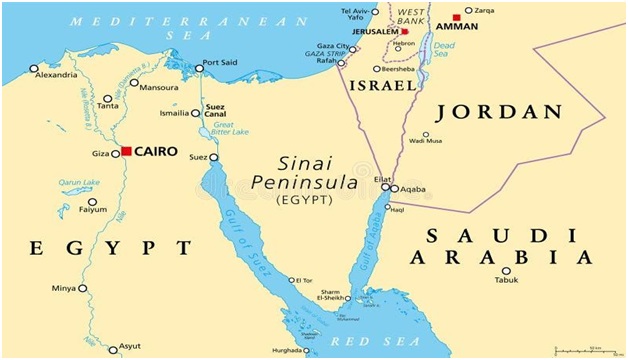
Hundreds of tons of aid from multiple countries have been stationed in Egypt's Sinai Peninsula, awaiting an agreement for secure transportation to Gaza for several days.
About the Sinai Peninsula:
- Geographical Location: The Sinai Peninsula is a triangular landmass located in northeastern Egypt, serving as a critical land bridge that connects the continents of Asia and Africa.
- Size and Sovereignty: Encompassing an expansive area of 23,500 square miles (61,000 square km), the Sinai Peninsula is recognized as a sovereign territory within the boundaries of Egypt.
- Geographical Boundaries: It is bordered to the north by the Mediterranean Sea and to the east by Israel and the Gaza Strip.
- The Suez Canal lies to the west, acting as a separation from the African part of Egypt.
- To the southwest, the Gulf of Suez and the Red Sea border the peninsula, while the Gulf of Aqaba marks its southeastern boundary.
- Egypt shares maritime borders in the Sinai with Jordan and Saudi Arabia.
- Historical Significance: In the late 19th century, including the Sinai Peninsula, Egypt became part of the British Empire until gaining independence in 1922.
- During the Six-Day War of June 1967, the peninsula was occupied by Israeli forces and returned to Egypt in 1982 as part of the peace treaty signed in 1979.
- Diverse Geography: The Sinai Peninsula is characterized by a diverse landscape, featuring mountain ranges, deserts, plateaus, and coastal regions.
- Population Composition: With a relatively sparse population, the Sinai is home to about 600,000 people, predominantly consisting of Arab Egyptians and Bedouins.
Hailstorms Damage Apple Orchards in Kulgam, Shopian (HT)
- 16 Oct 2023
Why in the News?
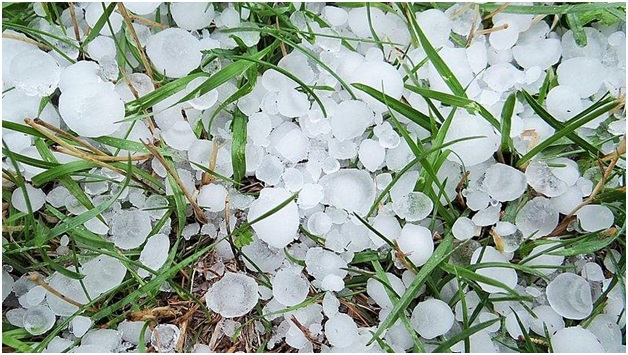
A hailstorm in the evening caused massive damage to the crops and fruits in south Kashmir’s Kulgam and Shopian districts. Residents said the hailstorm damaged the apple fruit which was ready for harvesting.
What are Hailstorms?
- Hail, a solid form of rain composed of ice balls or lumps, leads to the formation of hailstorms when they descend to the ground.
- Typically lasting around 15 minutes, these storms can inflict injuries and damage to structures, vehicles, and more, particularly prevalent in midlatitude regions.
- Hailstorms occasionally coincide with other severe weather phenomena such as cyclones and tornadoes.
- The size of hailstones varies widely, ranging from small pellets under 1/4 inch to larger stones measuring several inches in diameter.
- Conditions: Conditions conducive to hailstorm occurrence involve the presence of highly developed Cumulonimbus clouds, massive anvil-shaped formations observed during thunderstorms that can reach heights of up to 65,000 feet.
- Strong updrafts, or ascending air currents within these clouds, and high concentrations of supercooled liquid water are essential elements.
- Formation of Hail: Hail formation begins with a water droplet lifted by an updraft inside a thundercloud.
- As it ascends, supercooled water droplets adhere to its surface, creating layers of ice.
- With continued ascent, the hail embryo grows by accumulating more supercooled particles until gravity pulls it down.
- Large hailstones often display alternating layers of clear and opaque ice due to irregular rates of freezing during their development.
Vice President Interacted With Inter-Parliamentary Union (IPU) President During P20 Summit (PTI)

- 14 Oct 2023
Why in the News?
Vice President Jagdeep Dhankhar recently hosted a lunch for heads of parliamentary delegations attending the G20 Parliamentary Speakers' Summit (P20) and also interacted with Inter-Parliamentary Union (IPU) President Duarte Pacheco.
About the Inter-Parliamentary Union (IPU):
- Established in 1889 in Paris, the Inter-Parliamentary Union (IPU) is the international organization of Parliaments, dedicated to promoting representative democracy and world peace.
- It serves as the first multilateral political organization globally, fostering cooperation and dialogue among all nations.
- Mission and Slogan: The IPU's mission revolves around parliamentary diplomacy, empowering parliaments, and parliamentarians to advance peace, democracy, and sustainable development worldwide.
- Its slogan, "For democracy. For everyone," encapsulates its commitment to democratic values.
- Membership and Promotion of Democracy: Currently comprising 179 member parliaments and 13 associate members, the IPU actively promotes democracy by strengthening parliaments, and fostering youth inclusion, gender balance, and diversity.
- A dedicated committee defends the human rights of parliamentarians globally.
- Headquarters and Funding: The IPU relocated its headquarters to Geneva in 1921.
- Financed primarily by its members using public funds, the organization sustains its operations and initiatives.
Organizational Structure:
- IPU Assembly: Principal statutory body expressing IPU views on political issues.
- Gathers parliamentarians to study international problems and make actionable recommendations.
- Governing Council: Plenary policymaking body composed of three representatives from each member parliament.
- Establishes the IPU's annual program, and budget, and considers substantive issues.
- Executive Committees: A 17-member body overseeing IPU administration and advising the Governing Council.
- Fifteen members elected by the Council for a four-year term.
- Standing Committees: Three committees set up by the Governing Council to assist the Assembly in its work.
- Meeting of Women Parliamentarians: A separate organ meeting during the first round of Statutory Meetings, reporting to the Governing Council.
- Attended by parliamentarians of both sexes, focusing on specific substantive items for debate within the Assembly's competence.
India, Sri Lanka Launch Ferry Service Across Palk Strait (The Hindu)
- 14 Oct 2023
Why in the News?
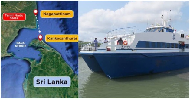
An international, high-speed passenger ferry service between Nagapattinam on the eastern coast of Tamil Nadu and Kankesanthurai in the northern province of Sri Lanka, has resumed as of Saturday, October 14, 2023, after a gap of nearly four decades.
About the Palk Strait:
- Palk Strait, situated between the Indian state of Tamil Nadu and the island nation of Sri Lanka, derives its name from Robert Palk, the governor of Madras Presidency (1755-1763) during the British Raj.
- Bounded by Pamban Island (India), Adam's (Rama's) Bridge, the Gulf of Mannar, and Mannar Island (Sri Lanka) to the south, the strait serves as a crucial link connecting the Bay of Bengal in the northeast with the Gulf of Mannar in the southwest.
- The southwestern segment of the strait is referred to as Palk Bay.
- Spanning 40 to 85 miles (64 to 137 km) in width, 85 miles in length, and with a depth of less than 330 feet (100 meters), it features the inflow of several rivers, including Tamil Nadu's Vaigai River.
- The port of Jaffna, serving as the commercial hub for northern Sri Lanka, is situated along this significant waterway.
Facts About Adam's Bridge:
- Adam's Bridge, also recognized as Rama's Bridge or Rama Setu, constitutes a series of limestone shoals situated between Pamban Island (Rameswaram Island) off the south-eastern coast of Tamil Nadu, India, and Mannar Island off the north-western coast of Sri Lanka.
- Geological evidence supports the idea that this bridge once formed a land connection between India and Sri Lanka.
- Extending over 50 km, it delineates the separation between the Gulf of Mannar to the southwest and the Palk Strait to the northeast.
- Featuring dry sandbanks and shallow waters ranging from 1 to 10 meters in depth, hindering navigation, scientists posit that Ram Setu is a natural formation resulting from tectonic movements and the entrapment of sand in corals.
- Significantly, this structure holds cultural significance in Hindu and Muslim mythology.
- Hindus believe it to be the bridge constructed by Lord Ram and his army for their journey to Lanka to confront Ravan.
- According to Islamic legend, Adam traversed this bridge to reach Adam’s Peak in Sri Lanka, where he purportedly stood on one foot in repentance for 1,000 years.
Manipur to Conduct Census of Amur Ffalcon (The New Indian Express)
- 14 Oct 2023
Why in the News?
The Manipur Forest Department will conduct the first-ever Amur falcon census. This initiative in India is one of the several programs the agency is running to safeguard migrating birds.
About Amur Falcon:
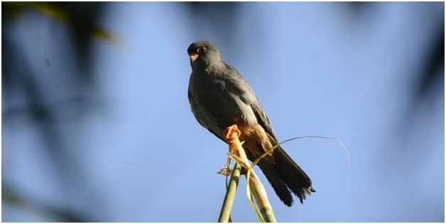
- The Amur Falcon, a diminutive member of the falcon family locally known as Akhuipuina, predominantly frequents Manipur and Nagaland.
- Originating from southeastern Siberia and northern China, these birds embark on extensive migrations in vast formations to winter in Southern and East Africa, covering a one-way journey of approximately 20,000 km through India twice a year.
- In terms of conservation, the Amur Falcon is safeguarded by the Wildlife Protection Act of 1972, listed under Schedule IV.
- Hunting or possession of its meat is subject to legal repercussions, including imprisonment for up to three years, a fine of up to 25,000, or bonds.
- Initiating a conservation effort in 2018, the forest department employed radio tagging to study the birds' migratory routes.
- As per the International Union for Conservation of Nature (IUCN), the Amur Falcon is categorized as "Least Concern."
- Despite this, the species faces threats such as illegal trapping and killing during migration, along with habitat loss due to agricultural practices and land reclamation.
Egypt is Racing to Eliminate Hepatitis C (The Hindu)

- 14 Oct 2023
Why in the News?
Recently the WHO announced that Egypt had made “unprecedented progress” towards eliminating hepatitis C.
Context:
- As per the World Health Organization (WHO), Egypt has attained a significant milestone by becoming the inaugural country to reach the "gold tier" status in its pursuit of eliminating hepatitis C, meeting the criteria established by the global health organization.
- Egypt has successfully identified 87% of individuals with hepatitis C and has administered curative treatment to 93% of those diagnosed, surpassing the WHO's gold-tier benchmarks.
- These targets include diagnosing a minimum of 80% of individuals with hepatitis C and offering treatment to at least 70% of those identified, marking a commendable achievement for Egypt in the global effort against the disease.
What is Hepatitis C?
- Hepatitis C is a viral infection impacting the liver, causing both acute (short-term) and chronic (long-term) illnesses that can be life-threatening.
- Transmission occurs through contact with infected blood, such as sharing needles, unsafe medical procedures like unscreened blood transfusions, and vertical transmission from an infected mother to her baby.
- It can also be transmitted through certain sexual practices involving blood exposure.
- Contrary to misconceptions, Hepatitis C is not spread through breast milk, food, water, or casual contact like hugging, kissing, or sharing food/drinks with an infected person.
- Symptoms encompass fever, fatigue, loss of appetite, nausea, vomiting, abdominal pain, dark urine, and jaundice (yellowing of the skin or eyes).
- Geographically, this viral infection is present in all WHO regions, with the Eastern Mediterranean Region and European Region bearing the highest disease burden.
- New infections often lack symptoms, making diagnosis challenging, and chronic infections may remain asymptomatic for decades until severe liver damage prompts noticeable symptoms.
- While no vaccine exists for Hepatitis C, antiviral medications offer effective treatment options.
What is Gold Tier Status?
- Gold tier status involves fulfilling distinct criteria, which encompass:
- Guaranteeing 100% blood and injection safety, with a commitment to maintaining a minimum of 150 needles/syringes annually for individuals who inject drugs (PWID).
- Achieving a diagnosis rate of over 80% for individuals living with chronic hepatitis C virus (HCV).
- Providing treatment to over 70% of individuals diagnosed with HCV.
- Instituting a sentinel surveillance program for hepatitis sequelae, with a focus on conditions such as liver cancer.
Centre Notifies Green Credit Programme and Ecomark Scheme (DownToEarth)

- 14 Oct 2023
Why in the News?
The Union Ministry of Environment, Forests and Climate Change on October 13, 2023, notified the ‘green credit’ programme, a first-of-a-kind market-based instrument designed to incentivise individuals, industries and local bodies for their voluntary environmental actions across diverse sectors.
About Green Credit Programme (GCP):
- Green Credit Program (GCP ) is an innovative market-based mechanism designed to incentivize voluntary environmental actions across diverse sectors, by various stakeholders like individuals, communities, private sector industries, and companies.
- The GCP's governance framework is supported by an inter-ministerial Steering Committee and The Indian Council of Forestry Research and Education (ICFRE) serves as the GCP Administrator, responsible for program implementation, management, monitoring, and operation.
- In its initial phase, the GCP focuses on two key activities: water conservation and afforestation.
- A user-friendly digital platform will streamline the processes for registration of projects, verification, and issuance of Green Credits.
- The Green Credit Registry and trading platform, being developed by ICFRE along with experts, would facilitate the registration and thereafter, the buying and selling of Green Credits.
- To obtain Green Credits, individuals and entities must register their activities through the central government's dedicated app/website www.moefcc-gcp.in.
- The Administrator will verify the activity through a designated agency, with self-verification for small projects.
- Once verification is complete, the Administrator will grant a Green Credit certificate which will be tradable on the Green Credit platform.
What is the Ecomark Scheme?
- The Ecomark Scheme provides accreditation and labelling for household and consumer products that meet specific environmental criteria while maintaining quality standards as per Indian norms.
- Products accredited under the Ecomark Scheme will adhere to specific environmental criteria, ensuring minimal environmental impact.
- It will build consumer awareness of environmental issues and encourage eco-conscious choices.
- It will also motivate manufacturers to shift towards environmentally friendly production. The scheme seeks to ensure accurate labelling and prevent misleading information about products.
- The Central Pollution Control Board administers the Ecomark Scheme in partnership with the Bureau of Indian Standards (BIS), which is the national body for standards and certification.
Both initiatives mark significant steps in promoting sustainable living, and environmental conservation, and, through individual and collective choice, embody eco-friendly practices in India. They align with global sustainability goals and reflect the government's commitment to conservation and protection of the environment.
New Toad Species Discovered in Dampa Tiger Reserve of Mizoram (HT)
- 12 Oct 2023
Why in the News?
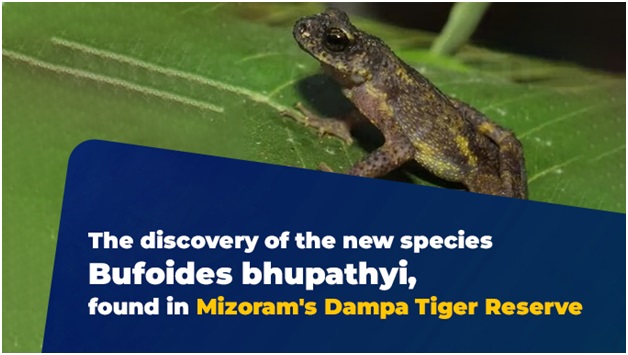
A group of scientists from India and the United Kingdom have discovered a new species of toads, the third of a genus found only in a very narrow area in northeast India.
About the Recently Discovered Toad Species:
- This newfound toad species, belonging to the bufoides genus, marks the third identified within a limited area in northeast India.
- Distinguished by its interdigital webbing, unique colouration, skin tuberculation, and the existence of ovoid, tuberculated, and depressed parotid glands, this species adds to the diversity of its genus.
- The preceding species from the same genus, Bufoides meghalayanus and Bufoides kempi, were previously identified in the region of Meghalaya.
- In recognition of its discovery and to honour the significant contributions of the renowned herpetologist S. Bhupathy, this new species has been aptly named after him.
About the Dampa Tiger Reserve:
- Situated in the Lushai Hills on the western side of Mizoram, the Dampa Tiger Reserve holds significance for its unique features.
- Establishment: Designated as a tiger reserve in 1994 under the Project Tiger initiative.
- Geographical Boundaries: Bordered on the west by the Chittagong hill tracts (Sazek hill range) of Bangladesh.
- The terrain is characterized by hills, with elevations ranging from 49 to 1095 meters above mean sea level.
- Prominent peaks include Chhawrpialtlang (1095m), Dampatlang (869m), and Pathlawilunglentlang (780m).
- Vegetation Diversity: Encompassing tropical evergreen to semi-evergreen forests, the reserve boasts a diverse range of vegetation.
- River Systems: Drained by the Khawthlangtuipui River in the west and the Teirei River in the east, with tributaries like Keisalam, Seling, and Aivapui flowing through the reserve.
- Fauna: Diverse mammalian species inhabit the reserve, including Hoolock Gibbon, Rhesus Macaque, Assamese Macaque, Pig-Tailed Macaque, Stump-Tailed Macaque, and Phayre’s Leaf Monkey.
- Flora: The reserve boasts a rich flora, featuring species such as Dipterocarpus turbinatus, Dipterocarpus marcocarpus, Terminalia myriocarpa, and Michelia champaca, among others.
Project Nilgiri Tahr’ Launched in Tamil Nadu (The Hindu)
- 12 Oct 2023
Why in the News?
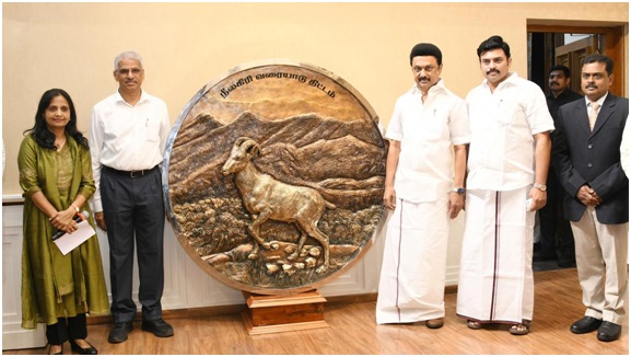
Consolidating efforts towards the conservation of Tamil Nadu’s State Animal, Chief Minister M.K. Stalin on Thursday, October 12, 2023, launched the ‘Project Nilgiri Tahr’ from the Secretariat in Chennai.
About Nilgiri Tahr:
- The Nilgiri Tahr, scientifically known as Nilgiritragus hylocrius, is an endangered mountain ungulate that is native to the southern part of the Western Ghats.
- Locally referred to as 'Varayaadu,' these creatures are renowned for their remarkable climbing abilities on steep cliffs, earning them the moniker "Mountain Monarch."
- Notably, the Nilgiri Tahr holds the distinction of being the state animal of Tamil Nadu.
Distribution:
- The current range of Nilgiri Tahrs is confined to approximately 5% of the Western Ghats in southern India, specifically in the states of Kerala and Tamil Nadu.
- The Eravikulam National Park in Kerala is home to the highest density and the largest surviving population of Nilgiri Tahrs.
Habitat:
- Nilgiri Tahrs inhabit open montane grassland habitats, thriving at elevations ranging from 1200 to 2600 meters in the South Western Ghats.
Distinctive Features:
- Characterized by a stocky body, short coarse fur, and a bristly mane, Nilgiri Tahrs exhibit sexual dimorphism, with mature males being larger and darker in colour.
- Both males and females possess curved horns, with males having larger ones measuring up to 40 cm, while females' horns reach approximately 30 cm.
- Adult males develop a light grey area or 'saddle' on their backs, leading to the term 'saddlebacks.' The species is recognized by its short grey-brown or dark coat.
Conservation Status:
- The Nilgiri Tahr is classified as Endangered on the IUCN Red List, signifying the critical need for conservation efforts.
- Additionally, it is accorded the highest protection under the Wildlife (Protection) Act of India, 1972, listed in Schedule I.
ICRISAT Joins One CGIAR Global Initiative (The Hindu BusinessLine)
- 12 Oct 2023
Why in the News?
The International Crops Research Institute for the Semi-Arid Tropics (ICRISAT), a Hyderabad-based international research institute with a focus on tropical dryland agrifood system innovation, has joined the One CGIAR integrated partnership.
What is One CGIAR Global Initiative?
- The One CGIAR global initiative is designed to establish a cohesive approach to transform food, land, and water systems in response to the challenges posed by the climate crisis.
- This collaborative effort involves the CGIAR System Organisation and 12 research centres operating under the umbrella of One CGIAR.
- CGIAR is a publicly-funded network of research centres focused on agrifood systems, operating in over 80 countries.
Key Facts about ICRISAT:
- ICRISAT, a non-profit, non-political international research organization, is dedicated to agricultural research for development in Asia and sub-Saharan Africa.
- Its mission is to support farmers by providing improved crop varieties and hybrids, particularly aiding smallholder farmers in arid regions to combat climate change.
- The organization specializes in research on five highly nutritious, drought-tolerant crops: chickpea, pigeonpea, pearl millet, sorghum, and groundnut.
- Recognized for its impactful work, ICRISAT was awarded the 2021 Africa Food Prize for the Tropical Legumes Project, contributing to improved food security across 13 countries in sub-Saharan Africa.
- ICRISAT is headquartered in Hyderabad, Telangana State, India, with two regional hubs in Nairobi, Kenya, and Bamako, Mali.
- Through its research and initiatives, ICRISAT plays a crucial role in addressing agricultural challenges and promoting sustainable development in diverse regions.
India Ranks 111 in Global Hunger Index (The Hindu)
- 12 Oct 2023
Why in the News?
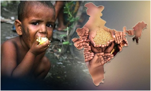
India ranks 111 out of a total of 125 countries in the Global Hunger Index (GHI) 2023, with its progress against hunger nearly halted since 2015, reflecting a global trend.
Key Findings of Global Hunger Index (GHI) 2023:
- India holds a Global Hunger Index score of 28.7 on a 100-point scale, categorizing its severity of hunger as "serious."
- The global GHI score for 2023 is 18.3, considered moderate.
- Latin America and the Caribbean stand out as the only region in the world where GHI scores have deteriorated between 2015 and 2023.
- South Asia and Africa South of the Sahara emerge as the global regions with the highest hunger levels, each having GHI scores of 27.0.
About the Global Hunger Index:
- The Global Hunger Index (GHI) is a tool designed to comprehensively measure and track hunger at global, regional, and national levels, reflecting multiple dimensions of hunger over time.
- The GHI is intended to raise awareness and understanding of the struggle against hunger, provide a way to compare levels of hunger between countries and regions and call attention to those areas of the world where hunger levels are highest and where the need for additional efforts to eliminate hunger is greatest.
- It is prepared jointly by Irish aid agency Concern Worldwide and the German organisation Welt Hunger Hilfe.
- How the GHI Is Calculated?
- Each country’s GHI score is calculated based on a formula that combines four indicators that together capture the multidimensional nature of hunger:
- Undernourishment: the share of the population whose caloric intake is insufficient;
- Child stunting: the share of children under the age of 5 who have low height for their age, reflecting chronic undernutrition;
- Child wasting: the share of children under the age of five who have low weight for their height, reflecting acute undernutrition; and
- Child mortality: the share of children who die before their 5th birthday, reflecting in part the fatal mix of inadequate nutrition and unhealthy environments.
- The indicators included in the GHI formula reflect caloric deficiencies as well as poor nutrition.
- The undernourishment indicator captures the food access situation of the population as a whole, while the indicators specific to children reflect the nutrition status within a particularly vulnerable subset of the population for whom a lack of dietary energy, protein, and/or micronutrients (essential vitamins and minerals) leads to a high risk of illness, poor physical and cognitive development, and death.
- The inclusion of both child wasting and child stunting allows the GHI to document both acute and chronic undernutrition.
- By combining multiple indicators, the index minimizes the effects of random measurement errors.
- These four indicators are all part of the indicator set used to measure progress toward the United Nations Sustainable Development Goals (SDGs)
Goan Cashew (kernel) Got the Geographical Indication (GI) Tag (Indian Express)
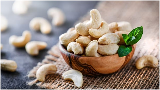
- 12 Oct 2023
Why in the News?
Goa Chief Minister Pramod Sawant hailed the recognition as a great opportunity for the cashew industry in the state and “a milestone towards the Swayampurna Goa mission”.
About Goan cashew:
- Cashew is one of the most important plantation crops in India, with significant cultivation in the state of Goa.
- Its introduction to India traces back to the 16th century (1570) when the Portuguese brought it from its native region in northeast Brazil, Latin America.
- Originally recognized for afforestation and soil conservation, cashews quickly gained prominence in Goa, occupying the largest area among horticultural crops.
- The climatic conditions conducive to its growth are well-suited to the Indian coastal areas, thriving under hot and humid circumstances.
Climatic Conditions:
- Soil and Climate: Well-drained deep sandy loam soils, ranging from sandy to laterite, prove to be ideal for cashew cultivation.
- Goa, known for its sandy loam, is a particularly favourable region for this crop.
- Adaptability: Cashew exhibits excellent adaptability to the coastal regions of India, thriving under temperatures ranging from 20 to 38 degrees Celsius.
- The relative humidity in the range of 60 to 95% is also conducive to its growth.
- Rainfall: Annual precipitation between 2000 to 3500mm supports the cultivation of cashews, ensuring optimal growth and development.
- Geographical Expansion: While traditionally associated with Goa, the cultivation of cashews is expanding to non-traditional areas in the plains of Karnataka, Madhya Pradesh, Chhattisgarh, and some parts of the Northeast hill region.
- Cashew's journey from its introduction by the Portuguese to becoming a vital crop in Goan agriculture highlights its adaptability and significance in the diverse agro-climatic regions of India.
What is a Geographical Indication Tag?
- A Geographical Indication (GI) tag is a distinctive emblem affixed to products originating from a specific geographical area, signifying unique qualities or a reputation inherently tied to that origin.
- Primarily employed for agricultural products, foodstuffs, wine and spirit drinks, handicrafts, and industrial items, the Geographical Indications of Goods (Registration and Protection) Act, 1999 in India aims to facilitate the registration and enhanced safeguarding of geographical indications associated with various goods.
- Under this act, the granted GI tag holds validity for a period of 10 years, with the provision for renewal upon expiration.
NSG Takes on Invasive Vilayati Kikar/Prosopis Juliflora (Indian Express)
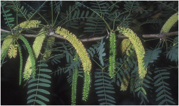
- 11 Oct 2023
Why in the News?
The National Security Guard (NSG) is actively combating the encroachment of the invasive plant species known as vilayati kikar at its Manesar campus, situated near the Delhi-Ajmer highway.
What is Prosopis Juliflora?
- Prosopis juliflora, a shrub or small tree belonging to the Fabaceae family and classified as a type of mesquite, is indigenous to Mexico, South America, and the Caribbean.
- Introduced to Delhi by the British in the 1920s during the construction of the national capital, this species is locally known by various names in India, including Bellary jaali, seemai karuvelam, seemai jaali, gando baval, and vilayati kikar.
- Known for its high ecological adaptability, Prosopis juliflora can thrive in diverse soil types, ranging from sand dunes to clay, and from saline to alkaline soils.
- It exhibits a wide altitude range, growing below 200 to above 1500 meters above sea level, with a mean annual rainfall varying from 50 to 1500 mm.
- However, despite its adaptability, it is recognized as an invasive plant with a propensity for vigorous growth, enabling it to outcompete indigenous plant species.
Impacts on the Environment: This invasive species pose significant environmental challenges:
- Prosopis juliflora absorbs more than four litres of water to produce one kilogram of biomass.
- The plant generates less oxygen and more carbon dioxide, making it less conducive to supporting bird habitats.
- It has the potential to contaminate groundwater, posing risks to the overall quality of this vital resource.
- The species contributes to land erosion by displacing grasslands that serve as habitats for native plants and animals.
- The invasive nature of Prosopis juliflora raises concerns about its ecological impact and necessitates efforts to manage and control its spread in affected regions.
Govt Notifies Changes in PLI Scheme for White Goods (Business Standard)

- 11 Oct 2023
Why in the News?
The central government has introduced changes to the rules governing the production-linked incentive (PLI) scheme for white goods, specifically air conditioners and light-emitting diode lights, with the goal of ‘simplifying the scheme’s operations’ and promoting the ease of doing business, according to an official statement on Wednesday.
What are White Goods?
- Major home appliances, commonly known as white goods, encompass substantial household devices like stoves, refrigerators, freezers, washing machines, tumble dryers, dishwashers, and air conditioners.
- While these durable consumer durables were initially available only in white, contemporary options offer a variety of colours, yet they persistently retain the term "white goods."
- Renowned for their robustness and extended lifespan, white goods are engineered to endure the rigours of daily use.
- Additionally, the term "white goods" may extend to white fabrics, particularly linen or cotton, including items like curtains, towels, or sheets, which historically were crafted from white cloth.
- In the beverage industry, the term "white goods" refers to colourless spirits such as vodka or gin.
What is Brown Goods?
- Brown goods refer to relatively lightweight electronic consumer durables, including computers, digital media players, TVs, and radios.
- In contrast to large household appliances (white goods), brown goods are primarily geared towards entertainment, communication, and convenience.
- Typically featuring electronic components, these devices are designed to deliver audio, video, or data-related services as their primary functions.
What is Grey Goods?
- When a commodity is traded through distribution channels, which are unofficial but legal are known as the grey goods.
- They are goods that are traded in a specific area, where the manufacturer does not intend to sell the product, but with different specifications.
- Grey goods are sold without the knowledge of the original manufacturer.
- They are typically less costly than the ones that are available by the authorised distributor.
- Also, they might be made to pertain to some jurisdiction.
- Example: A factory-unlocked version of the iPhone. It is made to suit US standards but is sold in India for a lesser price than the iPhone made for Indian standards.
- When it comes to such Grey goods, the manufacturer does not provide any warranty for the product.
Migratory Birds Arrive in Odisha’s Chilika Before Winter (DownToEarth)
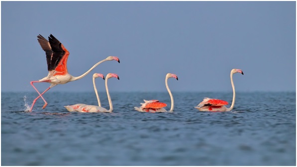
- 11 Oct 2023
Why in the News?
Migratory birds have started their annual journey to Chilika Lake—India’s largest waterbird habitat in Odisha — ahead of winter this year.
About Chilika Lake:
- Chilika Lake is the largest brackish water lake and a shallow lagoon with estuarine character spread across the districts of Puri, Khurda and Ganjam in the state of Odisha in eastern India.
- It is considered to be the largest lagoon in India and is counted amongst the largest lagoons in the world.
- It is the largest wintering ground for migratory waterfowl found anywhere on the Indian sub-continent.
- It is one of the hotspots of biodiversity in the country, and some rare, vulnerable and endangered species listed in the IUCN Red List of threatened Animals inhabit the Lake area for at least part of their life cycle.
- On account of its rich bio-diversity, Chilika Lake was designated as a "Ramsar Site", i.e. a wetland of International Importance.
- The Nalaban Island within the lake is notified as a Bird Sanctuary under the Wildlife (Protection) Act, 1972.
- The National Wetlands, Mangroves and Coral Reefs Committee of the Ministry of Environment & Forests, Government of India, have also identified the lake as a priority site for conservation and management.
- The Lake is a highly productive ecosystem, with rich fishery resources.
- The rich fishing grounds sustain the livelihood of more than 0.2 million fisherfolk who live in and around the lake.
- It has a great heritage value and maritime trade to the far east countries used to take place from here.
- It is the largest winter ground of migratory birds in the Indian sub-continent and home to more than 150 highly threatened Irrawaddy dolphins, which is the largest lagoonal population globally.
- It supports some of the largest congregation of migratory birds from large parts of Asia, particularly during the winters that arrive from as far as the Caspian Sea, Lake Baikal, Aral Sea, remote parts of Russia, Kirghiz steppes of Mongolia, Central and South East Asia, Ladakh and the Himalayas to feed and breed in its fertile waters.
NASA Recently Shared a Satellite Image of Deception Island (Tribune India)
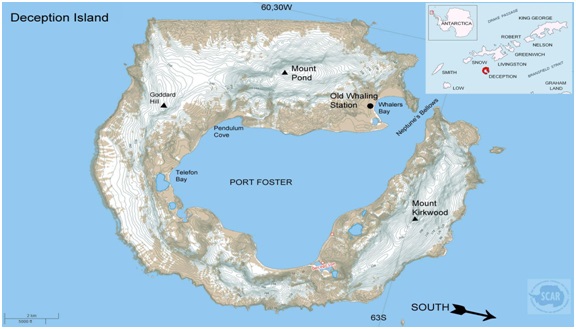
- 11 Oct 2023
Why in the News?
National Aeronautics and Space Administration (NASA) recently shared a satellite image of Deception Island, one of the only places in the world where a ship can sail directly into the centre of an active volcano.
About Deception Island:
- Deception Island is situated within the South Shetland Islands, forming part of an archipelago northwest of the Antarctic Peninsula.
- This volcanic island is notable for its dynamic features and distinct geography.
- Originating from a colossal volcanic eruption, Deception Island's formation resulted in the collapse of its central structure, allowing seawater to inundate the resulting caldera.
- The landscape is characterized by desolate volcanic slopes, steaming beaches, and glaciers adorned with ash layers, creating a unique horseshoe-shaped entrance to the sea via Neptune’s Bellows.
- The island encircles Port Foster, recognized as one of the safest harbours in the Antarctic, offering vessels a rare opportunity to navigate into the heart of an active volcano.
- Among the few places globally where this is possible, Deception Island has experienced over twenty eruptions since the 19th century.
- Notably, the island witnessed three volcanic eruptions from 1967 to 1970, leading to the destruction of Chilean and British stations.
- Presently, Argentina and Spain maintain summer scientific stations on the island.
- Deception Island is safeguarded under the Antarctic Treaty, designating it as a protected area with restricted human visits and minimized environmental impact.
Cabinet Approves Establishment of an Autonomous Body Mera Yuva Bharat (PIB)

- 11 Oct 2023
Why in the News?
The Union Cabinet, chaired by Prime Minister Shri Narendra Modi, has approved the establishment of an autonomous body Mera Yuva Bharat (MY Bharat).
About Mera Yuva Bharat (MY Bharat):
- Mera Yuva Bharat (MY Bharat), an autonomous body will benefit the youth in the age group of 15-29 years, in line with the definition of ‘Youth’ in the National Youth Policy.
- In the case of programme components specifically meant for adolescents, the beneficiaries will be in the age group of 10-19 years.
- It will help in Setting the focus of the Government on youth-led development and to make the Youth “active drivers” of development and not merely “passive recipients”.
- It will be launched on 31st October 2023 on National Unity Day.
Objective:
- The primary objective of Mera Yuva Bharat (MY Bharat) is to make it a whole of Government platform for youth development.
- With access to resources & connection to opportunities, youth would become community change agents and nation builders allowing them to act as the Yuva Setu between the Government and the citizens.
- It seeks to harness the immense youth energy for nation-building.
The establishment of Mera Yuva Bharat (MY Bharat) would lead to:
- Leadership Development in the Youth:
- Improve leadership skills through experiential learning by shifting from isolated physical interaction to programmatic skills.
- Investing more in youth to make them social innovators, and leaders in the communities.
- Setting the focus of the Government on youth-led development and making the Youth “active drivers” of development and not merely “passive recipients”.
- Better alignment between youth aspirations and community needs.
- Enhanced efficiency through Convergence of existing programmes.
- Act as a one-stop shop for young people and Ministries.
- Create a centralized youth database.
- Improved two-way communication to connect youth government initiatives and activities of other stakeholders that engage with youth.
- Ensuring accessibility by creating a digital ecosystem.
Why There is a Need for Such Initiative?
- India’s youth are to play a critical role in defining the future of the nation.
- There is a need to establish a new contemporary technology-led platform for the Government to engage with the present-day youth.
- Ensuring accessibility by creating a digital ecosystem
- Mera Yuva Bharat supported by a technology platform would help to increase the Youth outreach efforts of the Department of Youth Affairs.
Mukundra Hills Tiger Reserve in Rajasthan Now Opens for Safari Tours (TOI)
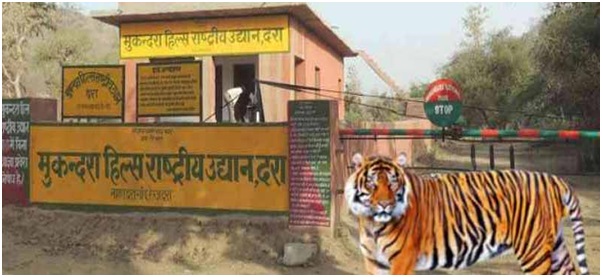
- 10 Oct 2023
Why in the News?
The forest department started the inaugural jungle safari at the Mukundra Hills Tiger Reserve on Monday, which marks the beginning of organised tiger reserve tours for tourists in four locations across the state.
About Mukundra Hills Tiger Reserve:
- Location: Mukundra Hills Tiger Reserve, also known as Darrah Wildlife Sanctuary, spans across four districts – Bundi, Kota, Jhalawar, and Chittorgarh in Rajasthan.
- The reserve is nestled in a valley formed by two parallel mountains, Mukundra and Gargola.
- Establishment: In 2013, the tiger reserve was formed, encompassing Mukandra National Park, Dara Sanctuary, Jawahar Sagar Sanctuary, and a section of Chambal Sanctuary.
- Initially, it served as a hunting preserve for the Maharaja of Kota.
- River: Positioned on the eastern bank of the Chambal River, the reserve is crisscrossed by its tributaries.
- Vegetation: The reserve features a Dry Deciduous Forest.
- Flora: The dominant species is Kala Dhok or Kaladhi (Anogeissus pendula), accompanied by Khair, Ber, Kakan, Raunj, and more.
- On elevated slopes, Anogeissus pendula gives way to Anogeissus latifolia, coexisting with Bel, Salar, Uum, and Shisham.
- Fauna: Noteworthy fauna include Leopard, Sloth bear, Nilgai, Chinkara, Spotted Deer, Small Indian Civet, Toddy Cat, Jackal, Hyena, Jungle Cat, and Common Langur, among others.
- The region is also home to various reptiles and amphibians, such as Pythons, Rat Snake, Buff-striped keelbacks, Green keelbacks, crocodiles, turtles, Gharial and Otters.
Periodic Labour Force Survey (PLFS) Says Unemployment Rate Declined (The Hindu)

- 10 Oct 2023
Why in the News?
The Periodic Labour Force Survey (PLFS) has reported that the unemployment rate in the country has shown a decrease between April and June 2023.
Key Observations of the Periodic Labour Force Survey (PLFS):
- Improved Work Metrics: Both the Labour Force Participation Rate (LFPR) and Worker-Population Ratio (WPR) showed positive trends in the recent period.
- Urban Employment Trends: In urban areas, LFPR increased from 47.5% (April-June 2022) to 48.8% (April-June 2023) for individuals aged 15 and above.
- The WPR in urban areas rose from 43.9% (April-June 2022) to 45.5% in the corresponding months this year.
- Gender-specific Changes:
- Male LFPR increased from 68.3% to 69.2%.
- Female LFPR showed notable growth from 18.9% to 21.1% during the observed period.
What is the Periodic Labour Force Survey (PLFS):
- Conducted by the National Sample Survey (NSO) under the Ministry of Statistics and Programme Implementation (MoSPI).
- Launched in April 2017 by the National Statistical Office (NSO) to provide more frequent labour force data.
Objectives:
- Estimate key employment and unemployment indicators every three months for urban areas.
- Annually estimate indicators for both 'Usual Status' and 'Current Weekly Status' in rural and urban areas.
- Key Indicators:
- Labour Force Participation Rate (LFPR): Percentage of individuals in the population who are part of the labour force (working, seeking, or available for work).
- Worker Population Ratio (WPR): Percentage of employed persons in the population.
- Unemployment Rate (UR): Percentage of unemployed persons among those in the labour force.
- Current Weekly Status (CWS): Activity status determined based on the activities in the last 7 days before the survey.
India to Hold Satellite Spectrum Auctioning (The Hindu BusinessLine)

- 10 Oct 2023
Why in the News?
The Elon Musk vs Mukesh Ambani battle on whether to auction or allocate satellite spectrum has attracted intervention from the Prime Minister’s Office (PMO).
What is Satellite Spectrum?
- The satellite spectrum is like a special section of radio waves reserved for satellites when they're up in space.
- It's part of the larger family of radio waves that we use for things like Wi-Fi, TV, and radio.
- This spectrum serves as a vital resource for countries, facilitating satellite broadcasting, communication, and weather services.
Key Points:
- Limited Resource: The satellite spectrum is finite, allocated for activities like satellite broadcasting and communication.
- It plays a crucial role in facilitating services provided by communication satellites and weather satellites.
- Frequency Bands: The spectrum is categorized into different frequency bands, chosen based on diverse applications.
- The frequency assigned during a satellite's construction remains unchanged post-launch.
- Impact on Data Transfer: The frequency of a signal dictates the speed of data transfer.
- Higher frequencies enable faster data transmission, but they also entail shorter wavelengths, leading to signal attenuation over distances and increased interference risks.
- Frequency Range: Satellites typically transmit in the frequency range of 1.5 to 51.5 gigahertz.
- High-speed broadband operations often use the higher end of this spectrum.
About International Telecommunication Union (ITU):
- Founded in 1865 as the International Telegraph Union, later becoming a specialized agency of the United Nations in 1947.
- Functions:
- Allocates global radio spectrum and satellite orbits.
- Coordinates and sets technical standards for telecommunication/ICT.
- Strives to enhance ICT access in underserved communities globally.
- Headquarters: Geneva, Switzerland.
- Membership: Comprises 193 countries and nearly 800 private sector entities and academic institutions.
- India's Association with ITU: India has actively participated in the ITU since 1869, maintaining a consistent presence on the ITU Council since 1952.
New Species of Bagworm Moth discovered From Idukki (The Hindu)
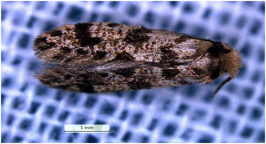
- 10 Oct 2023
Why in the News?
Researchers from the Zoology Department at St. Thomas College (Autonomous), Thrissur, have discovered a new species of bagworm moth, Wizard Bagworm, from near the Nariyampara Falls in the Idukki district.
What is a Bagworm Moth?
- Belonging to the family of moths in the order Lepidoptera, bagworm moths are recognized for their protective larval cases.
- These moths are distributed globally, with notable populations in North America and Africa.
- In their larval stage, these perennial moths inhabit various evergreen trees and junipers.
- They derive their name from the bag-like cases constructed by the larvae around themselves.
- The larvae can pose a threat to trees, particularly evergreens.
About Eumasia Venefica:
- This recently identified species earned its name due to the unique shape of its bag, resembling a wizard's hat.
- It is the fourth species within this genus to be documented in India.
- Distinctive Features:
- The species exhibits effective camouflage techniques to evade predators.
- Larval cases of Eumasia venefica are discovered attached to rocks adorned with lichens.
- These cases join together, forming a colony covered with lichens.
- The larval bags bear a resemblance to a 'witch's hat,' featuring a disc-like anterior and a tubular posterior part.
- Unlike polyphagous pests, the larvae of this species exclusively feed on algae and mosses present on rocks.
Pontus Tectonic Plate: Geologist Unexpectedly Finds Remnants of a Lost Mega-Plate (Science Daily)

- 10 Oct 2023
Why in the News?
Geologists have reconstructed a massive and previously unknown tectonic plate that was once one-quarter the size of the Pacific Ocean.
About Pontus Tectonic Plate:
- Recently discovered in the west Pacific Ocean, the Pontus Tectonic Plate is a long-lost geological plate that holds significance in Earth's history.
- Believed to have measured about 15 million square miles at its zenith, roughly equivalent to one-quarter of the Pacific Ocean, this massive tectonic plate dates back as far as 160 million years, with more recent traces extending to approximately 20 million years ago.
- Over millions of years, the Pontus Plate underwent a gradual subduction process, pulled downward beneath a neighbouring plate by the force of gravity.
How was this Discovery Made?
- The subducting process involves the plate sinking into Earth's mantle due to its higher density compared to the surrounding mantle.
- Traces of a subducted plate are discernible in the form of rock fragments concealed in mountain belts.
- During subduction, upper portions of the plate are occasionally scraped off.
- Researchers employed geological data and computer modelling to reconstruct the movements of current plates, revealing a substantial area potentially vacated by the subducted Pontus Plate.
- Utilizing magnetic techniques, scientists identified basalt remnants in Borneo as Pontus relics, suggesting that this fragmentary evidence was left behind during the plate's subduction some 85 million years ago.
What is Plate Tectonics?
- Tectonic plates are large, rigid pieces of Earth's lithosphere, the outer shell comprising the crust and uppermost part of the mantle.
- These plates, which vary in size and shape, constantly move and interact, shaping the Earth's dynamic surface.
- The Earth's lithosphere is divided into several major plates, such as the Pacific, North American, and Eurasian plates, among others.
- The interactions at plate boundaries result in various geological phenomena, including earthquakes, volcanic eruptions, and the formation of mountain ranges.
- Plate tectonics, the theory explaining these movements, underscores how heat-driven convective currents in the Earth's mantle cause plates to diverge, converge, or slide past each other.
- Tectonic plate movements influence the planet's topography, seismic activity, and the distribution of continents and oceans, playing a fundamental role in Earth's geological evolution.
Reliance General gets ?923cr GST notices from the Directorate General of GST Intelligence (DGGI) (TOI)

- 09 Oct 2023
Why in the News?
Reliance General Insurance Company (RGIC), a subsidiary of the Anil Ambani-led Reliance Capital, has received multiple show-cause notices worth Rs 922.58 crore from the Directorate General of GST Intelligence (DGGI).
About Directorate General of GST Intelligence (DGGI):
- Formerly known as the Directorate General of Central Excise Intelligence (DGCEI), the Directorate General of GST Intelligence (DGGI) stands as a premier intelligence organization operating under the Central Board of Indirect Taxes & Customs, within the Department of Revenue, Ministry of Finance.
- Its primary focus is on collecting, collating, and disseminating intelligence pertaining to Goods and Services Tax (GST) evasion and duties related to Central Excise and Service Tax on a pan-India basis.
- Evolution: Originally designated as the Directorate General of Anti-Evasion (DGAE), it was established in 1979 as an independent wing under the Directorate of Revenue Intelligence, New Delhi.
- Became a full-fledged Directorate in 1983, headed by a Director.
- In 1988, attained the status of Directorate General under a Director General.
- Currently comprises 04 offices of the Director General (East, West, North, and South), 26 Zonal Units, and 40 Regional Units.
Key Responsibilities:
- Intelligence Gathering: Collects information from various sources, including GST returns, financial statements, and other documents, to identify potential GST law violations.
- Investigation: Empowered to conduct investigations into suspected cases of GST evasion or non-compliance, involving summoning individuals, examining records, and executing searches and seizures.
- Enforcement: Enforces provisions of the GST law, taking legal action against offenders, imposing penalties, and recovering taxes or duties owed.
- Additional Functions: Collaborates with agencies like the Central Board of Indirect Taxes and Customs (CBIC) and State GST authorities for effective GST law implementation.
- Plays a crucial role in raising awareness about GST compliance and educating taxpayers on their legal obligations.
- Provides technical and legal assistance to field officers and other government entities involved in GST administration.
Mandarin-Trained Territorial Army Inducted At LAC (ET)

- 09 Oct 2023
Why in the News?
Recently the Territorial Army (TA) has inducted its first batch of Mandarin-trained officers to support the regular Army's efforts to enhance expertise in the Chinese language.
What is the Territorial Army (TA)?
- The Indian Territorial Army (TA) acts as the second line of defence, complementing the regular Indian Army.
- It is distinct in its role, being neither a profession, occupation, nor a source of employment.
- Reserved for individuals engaged in mainstay civilian professions, gainful employment or self-employment in a civil field is a prerequisite for joining the TA.
Key Roles:
- Relieving Regular Army: Primarily tasked with relieving the Regular Army from static duties.
- Assistance in Emergencies: Provides crucial assistance to civil authorities during natural calamities and tragedies.
- Essential Services: Aids civil administration in delivering essential services, particularly in areas facing stretched state machinery or security threats.
Service Commitment:
- Part-Time Service: TA volunteers typically serve in uniform for a few days annually, ensuring their readiness to bear arms for national defence during emergencies.
Historical Background:
- Established by the British in 1920 through the Indian Territorial Act, organized into 'The Auxiliary Force' for Europeans & Anglo-Indians and 'The Indian Territorial Force' for Indian Volunteers.
- The Territorial Army Act of 1948 formalized the TA, inaugurated by the first Indian Governor General, Shri C Rajagopalachari, on 9th October 1949.
- Motto: Savdhani Va Shoorta (Vigilance and Valour).
Eligibility Criteria:
- Nationality: Open to Indian citizens (Men & Women).
- Age: 18 to 42 years.
- Education: Graduate from any recognized university.
- Physical Standards: Must be physically and medically fit.
- Employment: Gainful employment in civilian professions.
- Exclusions: Serving members of the Regular Army/Navy/Air Force/Police/GREF/Para Military and similar forces are ineligible.
New Ensign for the Indian Air Force (HT)

- 09 Oct 2023
Why in the News?
Indian Air Force (IAF) Chief Air Chief Marshal (ACM) Vivek Ram Chaudhari on Sunday unveiled a new Ensign for the force, as it marked its 91st anniversary, by the inclusion of the Air Force Crest in the top right corner of the Ensign, towards the fly side.
About the Indian Air Force (IAF) Ensign:
- The new IAF Ensign exclusively incorporates the IAF Crest, featuring distinctive elements that symbolize the spirit and ethos of the Indian Air Force.
Key Elements:
- IAF Crest: The crest prominently showcases the national symbol, the Ashoka Lion, atop, with "Satyamev Jayate" in the Devanagari script beneath.
- Himalayan Eagle: Positioned below the Ashoka Lion, a Himalayan eagle with outstretched wings symbolizes the formidable fighting spirit of the IAF.
- Light Blue Ring: Encircling the Himalayan eagle, a light blue ring bears the words "Indian Air Force."
- IAF Motto: Derived from the Bhagavad Gita, the motto "Nabha Sparsham Deeptam" (touching the sky with glory) is inscribed in golden Devanagari below the eagle.
- The IAF crest serves as a powerful symbol of inspiration and encouragement.
Variations:
- IAF has adopted various crests for commands, squadrons, and other establishments, all adhering to a standard frame featuring the formation sign and a motto at the foot.
Historical Evolution:
- British Era: During the British era, the IAF was known as the Royal Indian Air Force, and its ensign featured the Union Jack and the RIAF roundel.
- Post-Independence: The current IAF Ensign, created post-independence, replaces the Union Jack with the Indian tricolour and the RAF roundels with the IAF tri-colour roundel in the lower right canton.
Govt Mulling Incentives for ASHA Workers (ET)

- 09 Oct 2023
Why in the News?
The government is planning to give incentives to ASHA health activists for mobilising eligible individuals for sickle cell disease screening and distribution of sickle cell cards for prevention and early detection of the disease.
About Accredited Social Health Activist (ASHA):
- ASHA serves as a trained female community health activist integral to the National Rural Health Mission initiated by the Government of India.
- Selected from the community and accountable to it, ASHA is trained to bridge the gap between the community and the public health system.
Key Functions:
- Acts as a care provider at the community level.
- Facilitates access to healthcare, medicine, and sanitation services.
- Health Awareness: Raises awareness of health issues among marginalized sections within the community.
- Advocate for Women's Health: Champions female health and hygiene standards.
- Advocates for a health-conscious approach to livelihood.
Implementation:
- The ASHA scheme is operational in all States/UTs, except Goa.
- States are mandated to employ at least one ASHA worker per every 1000 people.
- Inclusive Selection Process: The selection process involves various community groups, self-help groups, Anganwadi Institutions, and local committees.
Selection Criteria:
- Rural ASHA: Preferably a literate woman resident, married/widowed/divorced, aged 25 to 45 years, and preferably educated up to the 10th standard.
- Urban ASHA: Identified from vulnerable clusters, belonging to specific vulnerable groups, with good communication and leadership skills.
Compensation:
- Primarily an honorary volunteer compensated for specific situations.
- Ranges from Rs 2,000 to Rs 7,000, depending on the state.
- Incentives: Eligible for incentives under various national health programs.
Adani Ports' Flagship Mundra Port Completes 25 Years (ET)

- 09 Oct 2023
Why in the News?
Mundra Port in Gujarat has completed 25 years of its operations, highlighting its expansion and evolution as one of the largest ports globally.
About Mundra Port:
- Mundra Port stands as India's largest private and container port, situated on the north shores of the Gulf of Kutch near Mundra in the Kutch district of Gujarat.
- As a deep-draft, all-weather port, it holds the distinction of being a Special Economic Zone (SEZ).
- Managed by Adani Ports and Special Economic Zone Limited (APSEZ), the port is a pivotal player in India's cargo movement, accounting for nearly one-fourth of the nation's total.
- Mundra Port plays a crucial role in managing 33% of the country's container traffic.
- Key Features: Strategic Location: Positioned on the Gulf of Kutch, Gujarat.
- Handling Capacity: With an impressive capacity of 260 MMT, the port efficiently manages over 155 MMT (FY 2022-23), contributing to almost 11% of India's maritime cargo.
- Infrastructure: Boasting 26 berths and two single-point moorings, the port accommodates diverse vessels and handles various cargo types, including containers, dry bulk, break bulk, liquid cargo, and automobiles.
- Coal Import Terminal: Home to the nation's largest coal import terminal, Mundra facilitates swift cargo evacuation with minimal turnaround time.
- Rail Connectivity: The port's rail network is seamlessly integrated into the national rail network, ensuring efficient cargo handling for destinations across India.
SUGAM REC Mobile App for 54EC Bonds Investors (PIB)

- 07 Oct 2023
Why in the News?
Recently, REC Limited, the Maharatna Central Public Sector Enterprise launched a SUGAM REC mobile application.
What is the SUGAM REC App?
- The SUGAM REC App caters exclusively to current and prospective investors in REC's 54EC Capital Gain Tax Exemption Bonds.
- Users can conveniently download e-bond certificates, apply for new investments, access essential forms for KYC updates, and connect with REC's Investor Cell through call, email, or WhatsApp.
What are 54EC Bonds?
- Also known as Capital Gain Bonds, these fixed-income instruments offer capital gains tax exemption under section 54EC.
- Investors can save on income tax for long-term capital gains by investing in these bonds within six months of the gain.
- With a fixed lock-in period of 5 years, the bonds can be held in either Physical or Demat form.
- Issued by government-managed institutions, they fund specific capital projects and derive their name from the relevant section of the Income Tax Act, 1961.
Key Facts about REC Limited:
- A 'Maharatna' company under the Ministry of Power, Government of India.
- Registered with RBI as a non-banking finance company (NBFC), Public Financial Institution (PFI), and Infrastructure Financing Company (IFC).
- Established in 1969 to address severe drought and famine, focusing on energizing agricultural pump sets for irrigation and reducing reliance on monsoons.
- Provides long-term loans and financing products to State, Centre, and Private Companies for infrastructure asset creation.
- It is the nodal agency for initiatives like Pradhan Mantri Sahaj Bijli Har Ghar Yojana (SAUBHAGAYA), Deen Dayal Upadhaya Gram Jyoti Yojana (DDUGJY), and National Electricity Fund (NEF) Scheme.
NGT Investigates Removal of Invasive Mussels in Ennore-Pulicat Wetland (The Hindu)
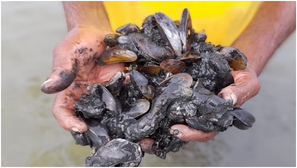
- 07 Oct 2023
Why in the News?
The Southern Bench of the National Green Tribunal (NGT) has asked the Fisheries Department and the Tamil Nadu State Wetland Authority to file a detailed report on the removal of invasive mussel species from the Ennore-Pulicat wetland.
What is Mytella strigata?
- Mytella strigata is a moderately large mussel known for its symmetrical shell, commonly found in the middle intertidal and subtidal waters of estuaries and coastal areas.
- These mussels attach to surfaces using byssus threads.
- Appearance: Individual mussels display diverse external colours such as black, dark bluish, brown, grey, orange, and occasionally green.
- The species exhibits various shell patterns, including zigzags, spots, or concentric bands.
- Habitat and Distribution: Found in dense clusters on hard substrates and in epibenthic habitats, Mytella strigata is prevalent along the Atlantic and Pacific coasts of tropical South and Central America.
- It has also expanded its presence to regions like Taiwan, the Philippines, Singapore, the Gulf of Thailand, the west coast of India, and the southeastern United States.
- Threats: These mussels pose a threat as they spread across river bottoms, forming carpets that hinder prawns from grazing or burying themselves in the sediment.
About Pulicat Lake:
- Pulicat is an extensive brackish-to-saline lagoon with marshes and a brackish swamp on the north.
- This is the second-largest saltwater lagoon in India and a Ramsar site (internationally recognized wetland under the Ramsar Convention).
- Only 16% of the lagoon is in Tamil Nadu; the rest is in Andhra Pradesh.
- It is fed by the Araani River at the southern tip and the Kalangi River from the northwest.
- Buckingham Canal, a navigation channel, passes through the lagoon.
- On the eastern boundary of this lagoon is Shriharikota Island, which separates the lagoon from the Bay of Bengal.
- The lagoon is shallow with large areas of mudflats and sandflats.
Watermeal May Become an Essential Food for Astronauts (India Today)
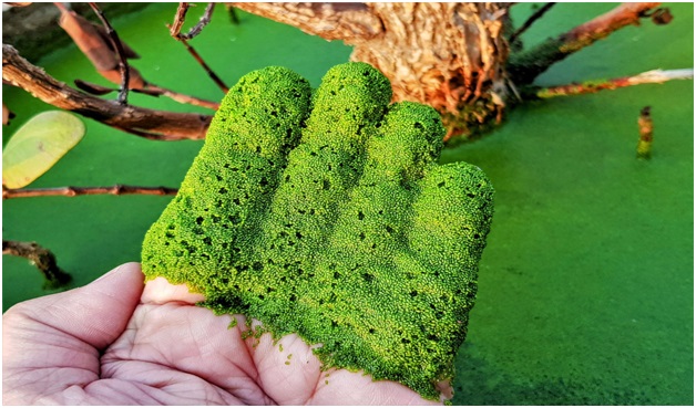
- 07 Oct 2023
Why in the News?
Scientists from Mahidol University in Thailand have been exploring the potential of watermeal, the smallest flowering plant on Earth, as a source of nutrition and oxygen for astronauts.
What is Watermeal?
- The Watermeal scientifically known as Wolffia, is often mistaken for algae, but they're actually the smallest flowering plants in the world!
- Its simplicity and rapid growth rate make it an ideal candidate for studying the effects of altered gravity on plant development.
- this tiny plant is aquatic, predominantly floating on the surface of water bodies.
- Because watermeal doesn’t have any roots, stems or leaves, it is basically just a sphere floating on a body of water.
- It's a prolific producer of oxygen through photosynthesis and belongs to the duckweed family (Lemnaceae).
- Each individual watermeal plant is extremely small, roughly the size of a pinhead.
- It has a simple, globular, and rootless structure, often appearing like minute green grains on the water.
- Watermeal thrives in quiet, nutrient-rich freshwater environments like ponds, lakes, and marshes.
- The plant is found globally, with a significant presence in Asia and Thailand.
- Watermeal is known to be a rich source of protein, making it a nutritious foodstuff.
- In Thailand, it has been part of the local diet for generations, appearing in dishes ranging from soups to salads.
Atmospheric Perturbations around the Eclipse Path (APEP) mission (HT)

- 07 Oct 2023
Why in the News?
Dr Aroh Barjatya, an Indian-origin scientist is set to lead the multi-institution NASA rocket mission on October 14.
About Atmospheric Perturbations around the Eclipse Path (APEP) mission:
- The APEP mission entails the launch of three rockets, each equipped with scientific instruments, to explore changes in the upper atmosphere during a solar eclipse, particularly during the critical phase of sudden light reduction.
- Mission Objective: To investigate alterations in the ionosphere induced by the abrupt decrease in sunlight during an eclipse, leading to the generation of waves in this atmospheric layer.
- Measurements will encompass changes in electric and magnetic fields, as well as variations in density and temperature.
- Launch Details: The launch site is the White Sands Missile Range in New Mexico, with a specific focus on studying the ionosphere's response during an eclipse.
- Potential Impact on Communications: NASA notes projections indicating a temperature and density reduction in the ionosphere during the eclipse, potentially causing disruptive wave disturbances that could affect GPS and satellite communications.
- Process: Rockets will be strategically positioned just beyond the path of annularity, where the Moon directly aligns with the Sun.
- Each rocket will deploy four compact scientific instruments designed to capture data on electric and magnetic fields, density, and temperature changes.
- NASA's primary objective is to achieve unprecedented simultaneous measurements from multiple ionospheric locations during a solar eclipse.
- Rationale for Rocket Selection: Sounding rockets were chosen for their precision in pinpointing and measuring specific regions of space.
- Their ability to investigate lower altitudes, inaccessible to satellites, makes them ideal for this mission.
- Sounding rockets offer precise data recording as they ascend and descend during suborbital flights, covering altitudes ranging from 45 to 200 miles (70 to 325 kilometres) above Earth's surface along their flight path.
Gangetic River Dolphin (The Hindu)
- 07 Oct 2023
Why in the News?
A recent publication by scientists and researchers has revealed that 19 Gangetic river dolphins had been rescued from the irrigation canals of the Ganga-Ghagra basin in Uttar Pradesh between 2013 and 2020.
About Gangetic River Dolphin:
- The Gangetic River dolphin is a freshwater species, representing one of the rare river dolphins worldwide.
- Distribution: It thrives in the river systems of Ganges-Brahmaputra-Meghna and Karnaphuli-Sangu, spanning across Nepal, India, and Bangladesh.
- Common Names: Known by various names such as Blind dolphin, Ganges dolphin, Ganges susu, hihu, side-swimming dolphin, and South Asian River Dolphin.
- Designated as India's National Aquatic Animal.
- Physical Features: Characterized by a long, thin snout, rounded belly, stocky body, and large flippers.
- Primarily feeds on fish, often found in counter-current systems of the main river channel.
- Eyes lack a lens, earning it the moniker 'blind dolphin.'
- Possesses an advanced bio-sonar system for effective hunting, even in murky waters.
- Requires surfacing every 30-120 seconds for breathing; its audible breathing sounds have led to the affectionate term 'Susu.'
- Conservation Status: IUCN categorizes it as Endangered.
- Protected under Schedule-I of the Wildlife (Protection) Act.
- Listed in CITES Appendix I.
Ichamati River (PIB)

- 06 Oct 2023
Why in the News?
The Minister of State for Ports, Shipping, and Waterways recently launched the dredging project on National Waterways 44 in the Ichamati River of West Bengal.
About the Ichamati River:
- The Ichamati River crosses both India and Bangladesh.
- It serves as a natural boundary between the two nations India and Bangladesh.
- It has three main sections.
- The longest part originates from the Mathabhanga River, a branch of the Padma River, flowing for 208 kilometers before merging with the Kalindi River near Hasnabad in North 24 Parganas and Debhata in the Satkhira District of Bangladesh.
- Additionally, the Ichhamati River and its tributaries together create a large oxbow lake complex in the North 24-Paraganas district, near Bangaon.
NanoPtA (The Hindu)

- 06 Oct 2023
Why in the News?
Scientists at the Indian Institute of Science's Materials Research Centre (MRC) have recently created a novel enzyme mimic known as NanoPtA.
About NanoPtA:
- The research team at the Materials Research Centre (MRC), Indian Institute of Science (IISc), has created a unique platinum-based nanozyme called NanoPtA.
- This nanozyme can be turned into a powder for use in industries.
- When NanoPtA encounters wastewater, the molecule's benzene rings and long alkyl chains engage in multiple non-covalent interactions.
- Individual NanoPtA molecules link together to form tape-like structures that emit light, which is the source of its oxidizing capability.
- In the presence of sunlight, this nanozyme can break down pollutants in wastewater, reducing its toxicity.
- Remarkably, the nanozyme can rapidly degrade even small amounts of common contaminants like phenols and dyes (micromolar levels) within ten minutes when exposed to sunlight.
- The researchers also observed that the NanoPtA complex remained stable for up to 75 days at room temperature.
Applications:
- Besides wastewater treatment, this nanozyme could find applications in healthcare and serve as a valuable diagnostic tool for neurological and neurodegenerative diseases.
BlueWalker 3 Satellite (The Hindu)

- 06 Oct 2023
Why in the News?
An international team of scientists has recently published a paper that explains how the prototype BlueWalker 3 satellite has affected the field of astronomy.
About the BlueWalker 3 satellite:
- The BlueWalker 3 satellite is a prototype that's part of a constellation owned by AST SpaceMobile.
- Launched in September 2022, it's notable for being one of the brightest objects in the night sky, even outshining the brightest stars.
- This satellite represents the largest-ever commercial communications array in low-Earth orbit, specifically designed to directly communicate with cellular devices at 5G speeds using 3GPP standard frequencies.
- Interestingly, the satellite operates at wavelengths close to those observed by radio telescopes, which could potentially interfere with radio astronomy.
National Turmeric Board (NTB) (PIB)

- 06 Oct 2023
Why in the News?
The Government of India recently announced the formation of the National Turmeric Board.
About the National Turmeric Board:
- The National Turmeric Board has a specific focus on developing and expanding turmeric and its products in India.
- It's especially dedicated to helping turmeric growers improve their skills and capabilities to add more value to their products.
- The Board also works to ensure high-quality and safe turmeric products.
- The composition of the Board includes a Chairperson appointed by the Central Government, members from various government departments such as AYUSH, Pharmaceuticals, Agriculture & Farmers Welfare, Commerce & Industry, as well as senior representatives from three states (on a rotational basis).
- Additionally, it includes representatives from national/state research institutions, turmeric farmers, and exporters.
- The Department of Commerce appoints a Secretary for the Board, and this department provides funds and infrastructure support.
- The NTB's main responsibilities include boosting demand, production, research, market connections, and exports related to turmeric.
PM Modi flags off RRTS: What is this mass transport system, and how it can benefit NCR (Indian Express)

- 20 Oct 2023
Why in the News?
The inauguration of the first segment of India's Regional Rapid Transit System (RRTS), the country's inaugural mass rapid transit system designed for regional connectivity, will be officiated by the Prime Minister of India.
About the Regional Rapid Transit System:
- The RRTS is an integrated mass transit network with semi-high-speed rail connectivity at its core.
- It aims to promote "balanced and sustainable urban development" throughout the National Capital Region (NCR) by improving connectivity and access.
- The National Capital Region Transport Corporation (NCRTC), a joint venture of the Central government and the governments of Delhi, Haryana, Rajasthan, and Uttar Pradesh, is building it.
- It is modeled after systems such as Paris' RER, Regional-Express trains in Germany and Austria, and SEPTA Regional Rail in the United States, among others.
- The project will develop eight corridors, three of which are currently under construction:
- the 82-kilometer Delhi-Ghaziabad-Meerut,
- the 164-kilometer Delhi-Gurugram-SNB-Alwar, and
- the 103-kilometer Delhi-Panipat corridors
- The importance of this system:
- The RRTS network is faster when compared to metros
- It will serve commuters who need to cover relatively longer distances across the NCR in a short amount of time.
- When compared to Indian Railways, the RRTS train will cover shorter distances but at a higher frequency and with greater comfort than the average railway coach.
List Niemann-Pick as a rare disease, parents of young patients (TOI)

- 20 Oct 2023
Why in the News?
Recently, parents of children with Niemann-Pick disease urged the Union government to notify the disease under the National Policy for Rare Diseases.
About Niemann-Pick Disease:
Niemann-Pick Disease is a rare genetic disorder characterized by the buildup of harmful substances in the body's cells and organs.
- Genetic Basis: It is inherited in an autosomal recessive manner, meaning that both parents must carry a mutated gene for their child to develop the disease.
- Types: There are several types of Niemann-Pick Disease, with types A and B being more common and types C and D being rarer.
- Lipid Accumulation: The disease is primarily characterized by the abnormal accumulation of lipids, specifically sphingomyelin, in various tissues and organs.
- Symptoms: Symptoms vary depending on the specific type of Niemann-Pick Disease but can include hepatosplenomegaly (enlarged liver and spleen), neurological problems, and lung issues.
- Type A: Niemann-Pick Disease Type A typically presents in infancy and can lead to severe neurological problems, making it a life-limiting condition.
- Type B: Niemann-Pick Disease Type B generally has a later onset and primarily affects the liver and spleen, with milder or absent neurological symptoms.
- Type C and D: Type C and D are characterized by cholesterol metabolism issues and can lead to neurological symptoms.
- Type C, in particular, can present with cognitive decline and movement problems.
- Treatment: There is currently no cure for Niemann-Pick Disease, but treatments aim to manage symptoms and may include enzyme replacement therapy, medications, and supportive care.
Niemann-Pick Disease is a complex condition with various subtypes, and the severity and specific symptoms can differ significantly among affected individuals.
Mangaluru | Archaeologist discovers inscription announcing the death of King KulashekaraAlupendra I at Someshwara (The Hindu)
- 20 Oct 2023
Why in the News?
During a recent archaeological exploration at Someshwara near Mangaluru, Karnataka, archaeologists unearthed a rare inscription related to the Alupa dynasty.
About the Someshwara inscription:
- This inscription holds great importance in understanding Tuluva history and culture.
- It features two panels on top, with the first line carved between them.
- The rest of the inscription, inscribed below the panels in Kannada script and the language of 12th century characters, announces Alupendra I's death.
- The human figures depicted in the inscription are KulashekaraAlupendra.
- He is depicted in the first figure standing in Tribhanga (tri-bent stance).
- He is holding a sword in his right hand and a gurani (shield) in his left.
- The King is represented in a sitting posture on a mound to the left of this panel, separated by a pillar, resting both palms on the center of his legs in dhyana mudra.
About the Alupa dynasty:
- The Alupa dynasty, active from the 2nd to the 15th century CE, ruled over Alvakheda Arusasira in the coastal regions of modern Karnataka.
- Initially independent, they later became vassals to powers like the Kadambas, Chalukyas, Rashtrakutas, and Hoysalas due to shifting politics in Southern India.
- They practiced matrilineal inheritance.
- Their descendants, known as the Bunt, continue to follow this system and bear surnames like Shetty, Rai, Hegde, Alva, and Chowta.
- While most are Hindus, some still follow Jainism.
- The last Alupa king, Kulasekharadeva Alupendradeva, is documented through a 1444 CE inscription in Mudabidri's Jain Basadi.
